Tag Archives: blue ridge mountains

Roan Highlands and String Bands

image

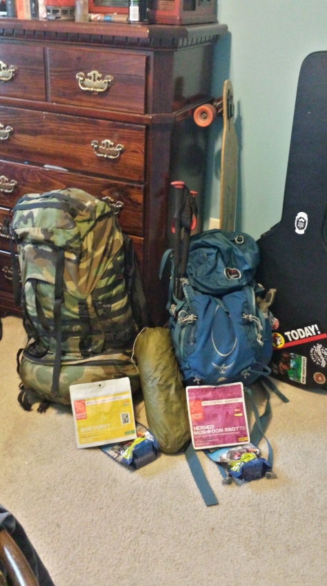
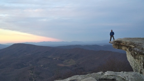
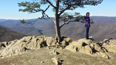
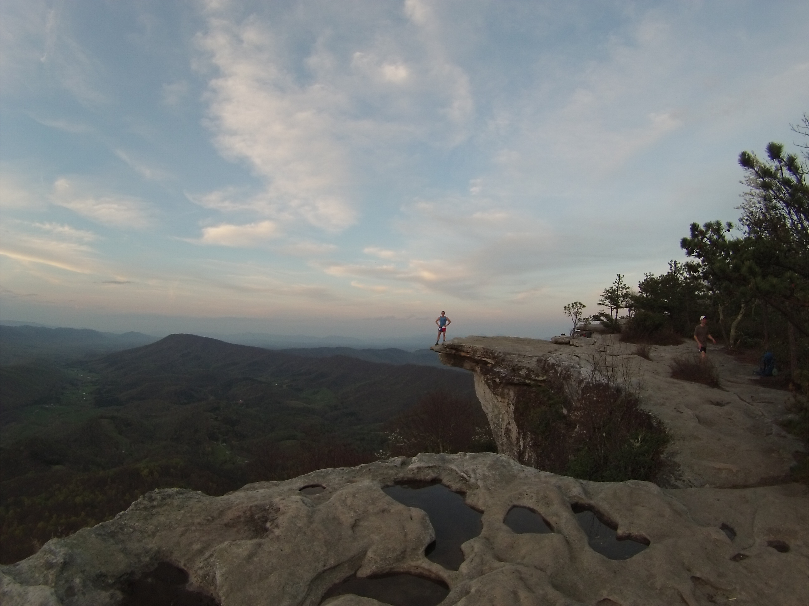
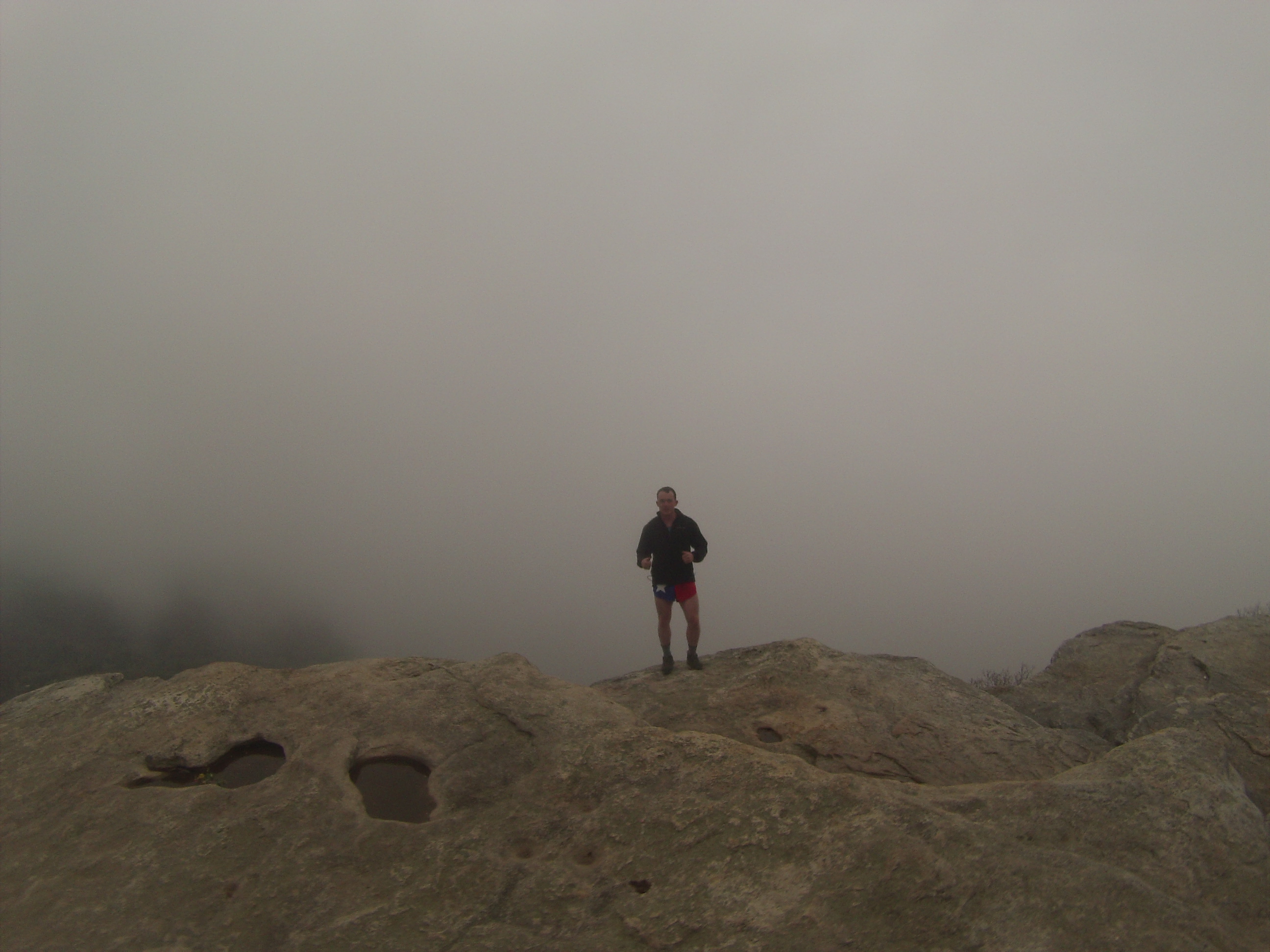
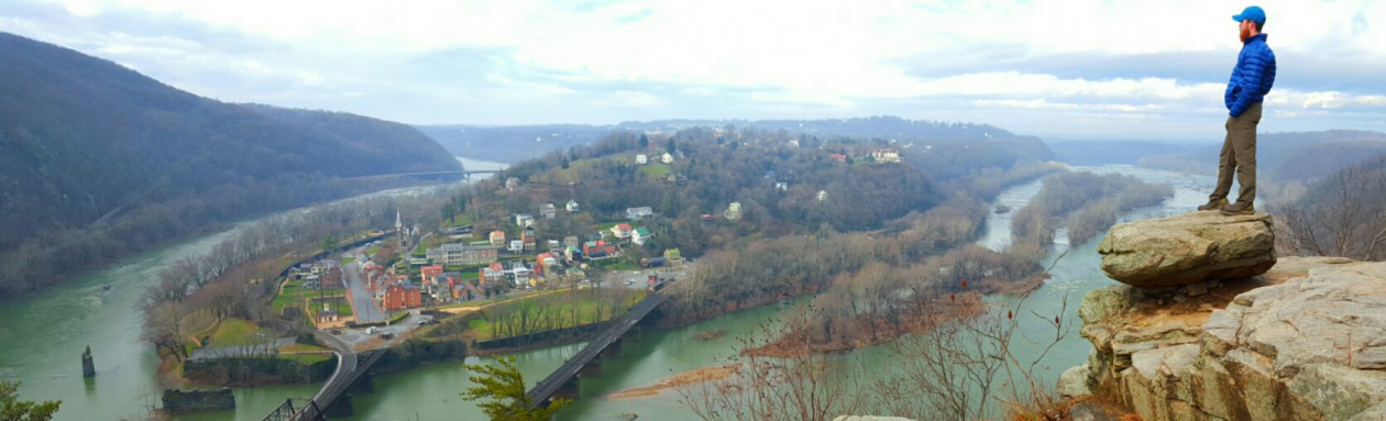
It’d been the better part of a month since I had gone on an adventure; directly after the New Year I went to McAfee Knob with my girlfriend to let her experience true tent camping for the first time. I frequently hike here in Fredericksburg along the Rappahannock River, but that will only satisfy my craving for so long. The itch had returned, so I checked the weather and, once again, saw that somehow the universe had conspired to deliver perfect conditions for one of my many last-minute trips.

After an hour of checking weather and driving distances, I called some friends who live on the Virginia and Tennessee border to see if they could shuttle me to and from Carver’s Gap, the entrance for day hikers and weekend warriors to the majestic Roan Highlands. As luck would have it they were free all weekend and happily agreed to shuttle me. Even better, they had an extra ticket to see Yonder Mountain String Band (YMSB) in Asheville Friday night and said it was mine. The band was set to play at The Orange Peel, a music venue in downtown Asheville that has been ranked as one of the top 5 live music venues in the country by Rolling Stone Magazine. Needless to say I was excited.

I left Fredericksburg Friday afternoon, meandering west down the back roads to I81, which I would drive south all the way to the state line, five hours away. The weather was perfect: clear, blue skies, 60 degrees and not much traffic. I had actually never heard of YMSB before, but I love string bands so I agreed as soon as they offered- who turns down free tickets anyways? Once that thought entered my mind I decided I should at least listen to some of their music to see what they sounded like. I pulled up the Spotify app on my phone and searched for the band, clicked “shuffle play”, and fell in love. They have a blue grass twang with a new age feel.

I arrived at the state line at 6 pm, parked at my friends’ house, and we departed for Asheville. It was already dark so we couldn’t see the mountains that the road was carving through, but we caught up and filled each other in on our lives during the hour and a half drive. The first thing we did once we got to Asheville was check into our 5-star room at the local Days Inn. All jokes aside, it was actually a lot nicer than I imagined when I heard where we were staying. After getting settled and stretching a bit, we caught an Uber to the Orange Peel two miles away. The roll-call line was already backed up so we took our place and waited; my friends were chatting with each other and I began people watching.
image

As we moseyed into the building I couldn’t help but notice that almost all of Asheville’s hipsters, with their skinny jeans and neck scarves, had turned out for the show. I wasn’t sure what to think about this, but I was still willing to give it a shot. We were standing near the back when the show started, but eventually made our way up to the very front of the audience. When the band began playing the crowd was instantly captivated, and you could see people dancing all over the floor as YMSB fired off their blazingly fast riffs and traded solos. From 9:45 pm to 1:15 am they played almost non-stop besides a thirty minute break. Most of the songs were their own, but they also covered some Grateful Dead hits (which the dirty hippies reeking of body odor and patchouli oil loved, but so did I), as well as “No Rain” by Blind Melon. I did not expect any of those covers from a string band, but damn was I pleased.
image


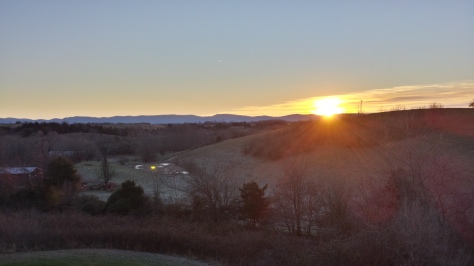
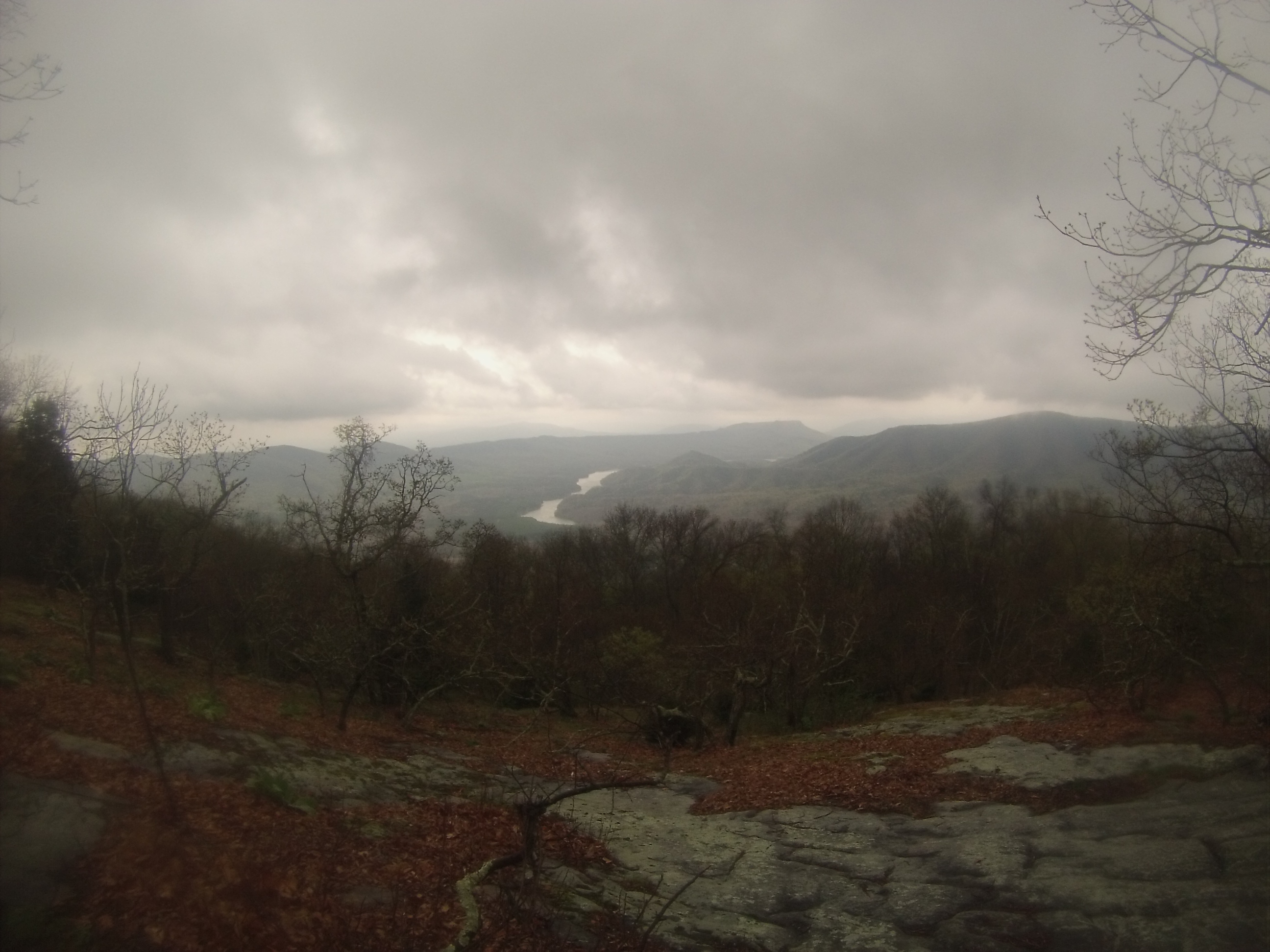
After the concert we called an Uber again, got some delicious and greasy food from Cook Out, and hit the hay. The next morning we got up and ate our complimentary breakfast of rubber eggs, surprisingly good bacon, and rotten bananas, and then headed for the Roan Highlands where they would drop me off. We decided to take the scenic route now that we could actually see where we were driving, and stopped at a few overlooks so I could take pictures. Such a tourist.
image

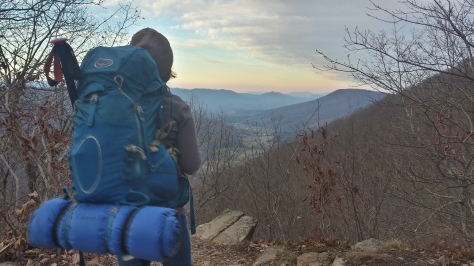
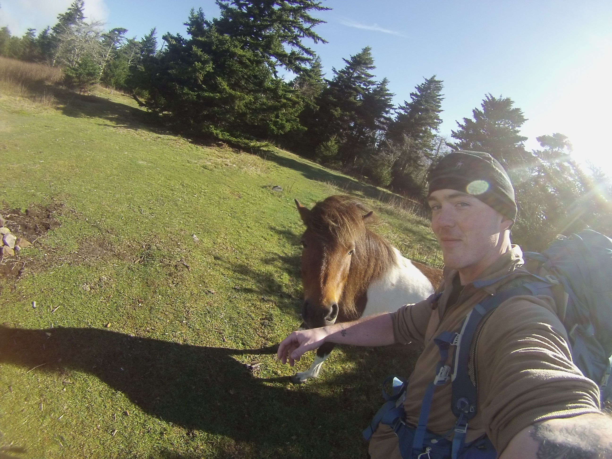
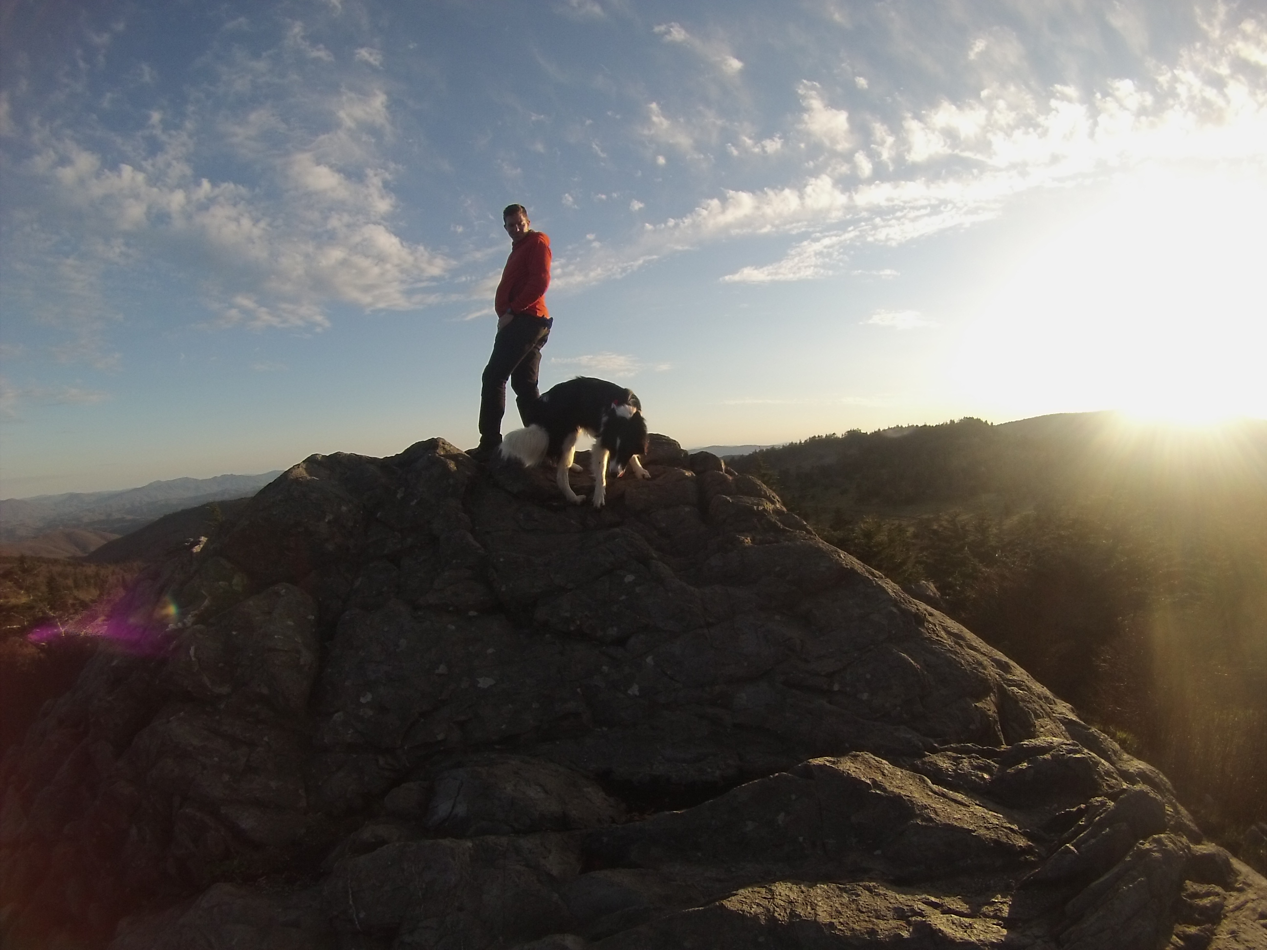
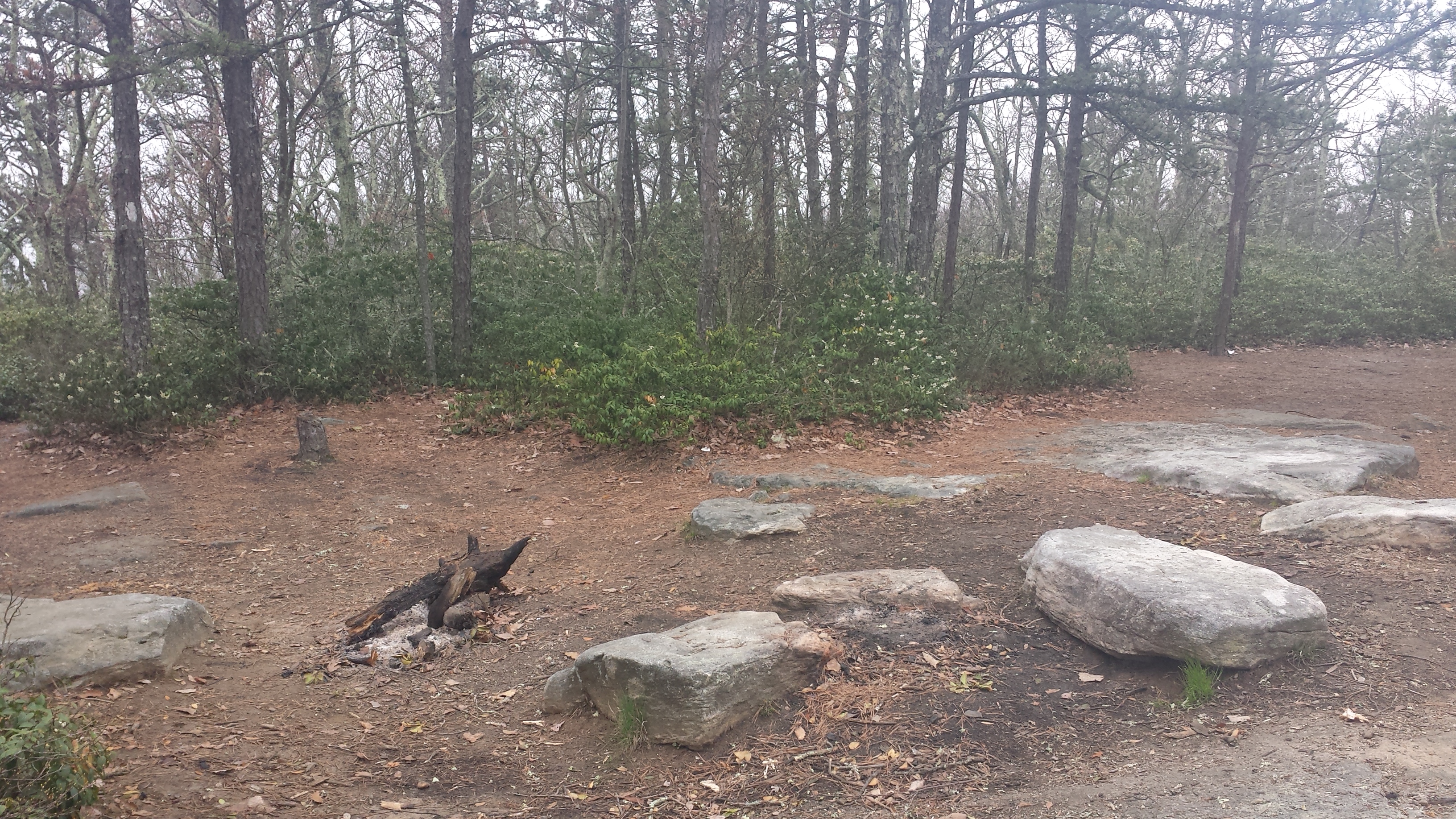
Normally I’m a mileage fiend, and if I don’t get in at least fifteen miles I feel like a wimp. Saturday, however, was not about that. The trip was meant to be a very leisurely walk in a breathtaking environment (literally and figuratively, it was at an elevation of over 6,000 feet) where I could relax and quiet my mind. I only hiked five miles each day, but it was all ridgeline walking above tree line with 360 degree views, and I took the time to talk to all the people I ran across for several minutes. From the retired Army officer to the mother taking her ten year-old daughter on a 30 mile section hike, I absolutely love getting a glimpse into random people’s lives. The fact that two absolute strangers, who probably only share a love of being in the mountains, can meet in the wilderness and freely share about their lives is one of the things I enjoy the most about hiking.
image

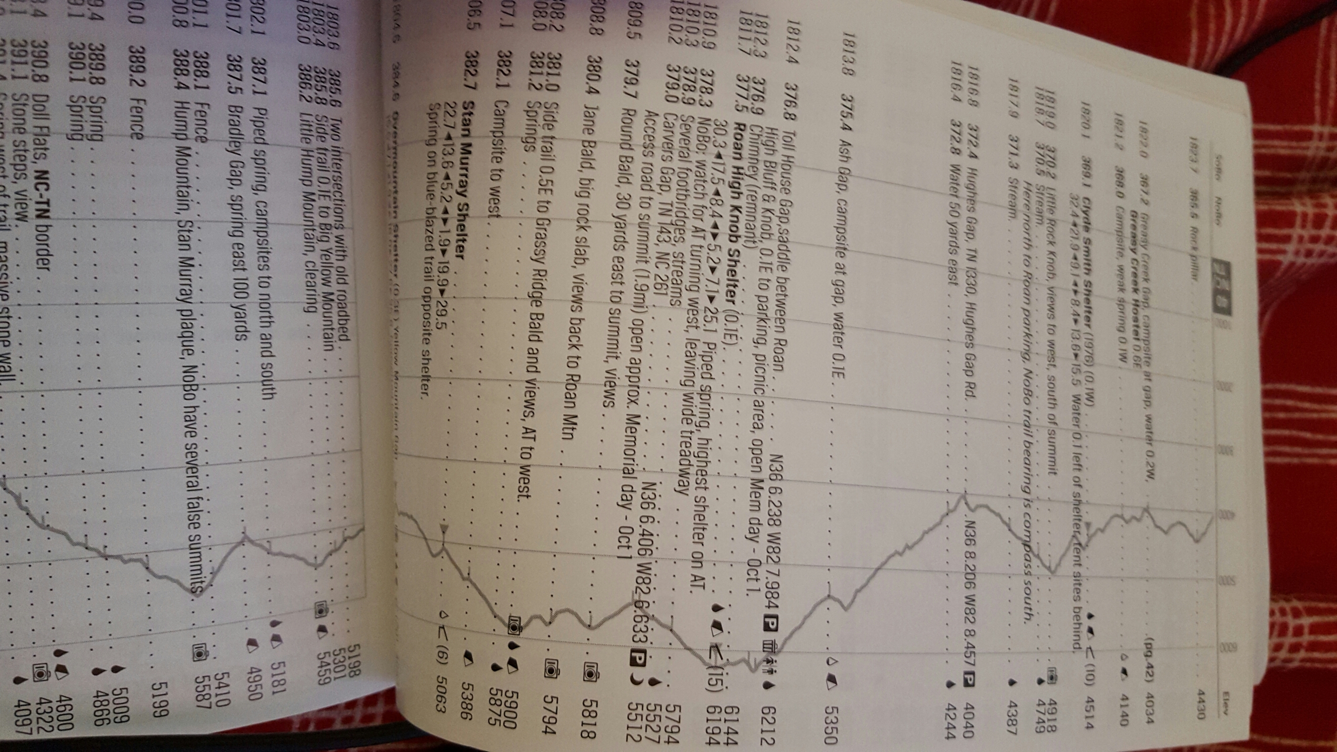
My destination for the day was an isolated portion of the Grassy Ridge Bald, which is reached by traipsing across the mountain tops on the Appalachian Trail for two miles before taking a side trail to the right. Grassy Ridge Bald is 6,165’, and offers magnificent views after a short half-mile jaunt up a somewhat steep trail. When I was here in October the trail was dirt, but this time the trek was considerably more treacherous as it was covered in ice. I have been considering purchasing a set of YakTraks, a brand of micro-spikes that you can strap to your shoes, for a while but haven’t really hiked in any conditions they might be necessary until then. No matter, I made it up the trail without falling, just a little slower than normal.
image

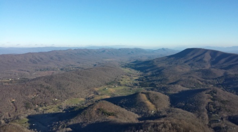
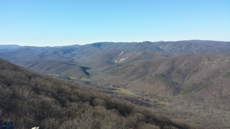
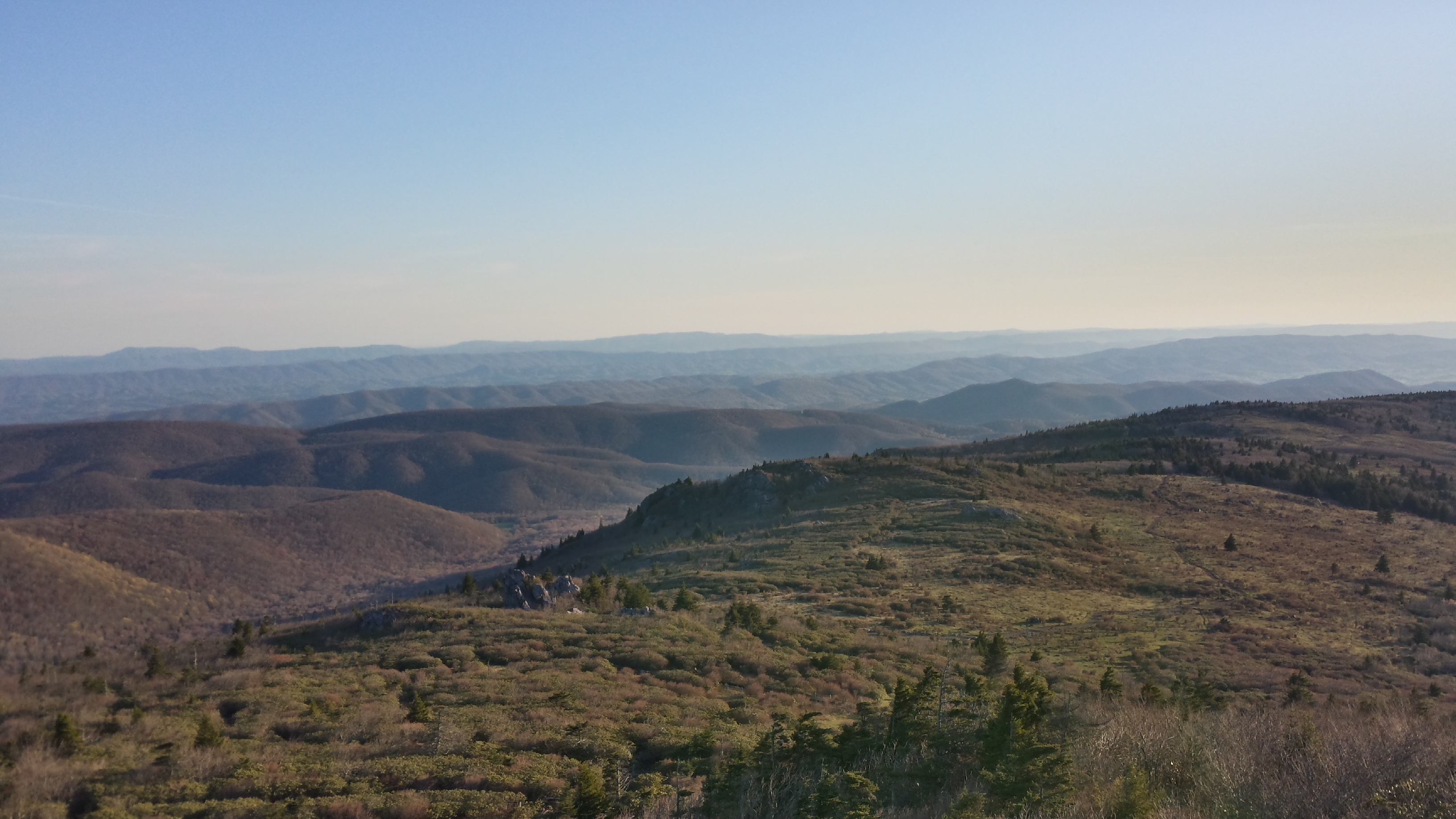
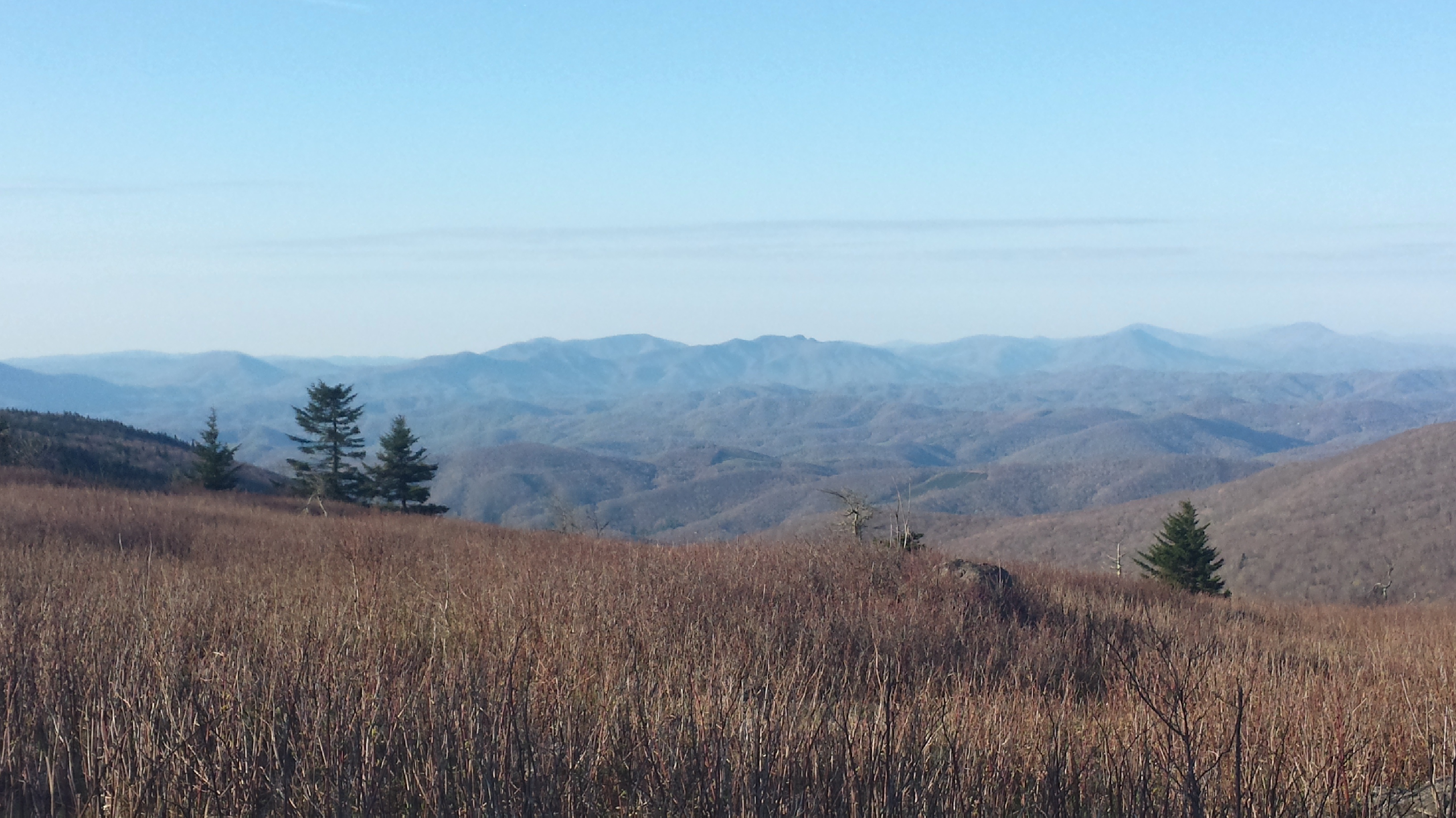
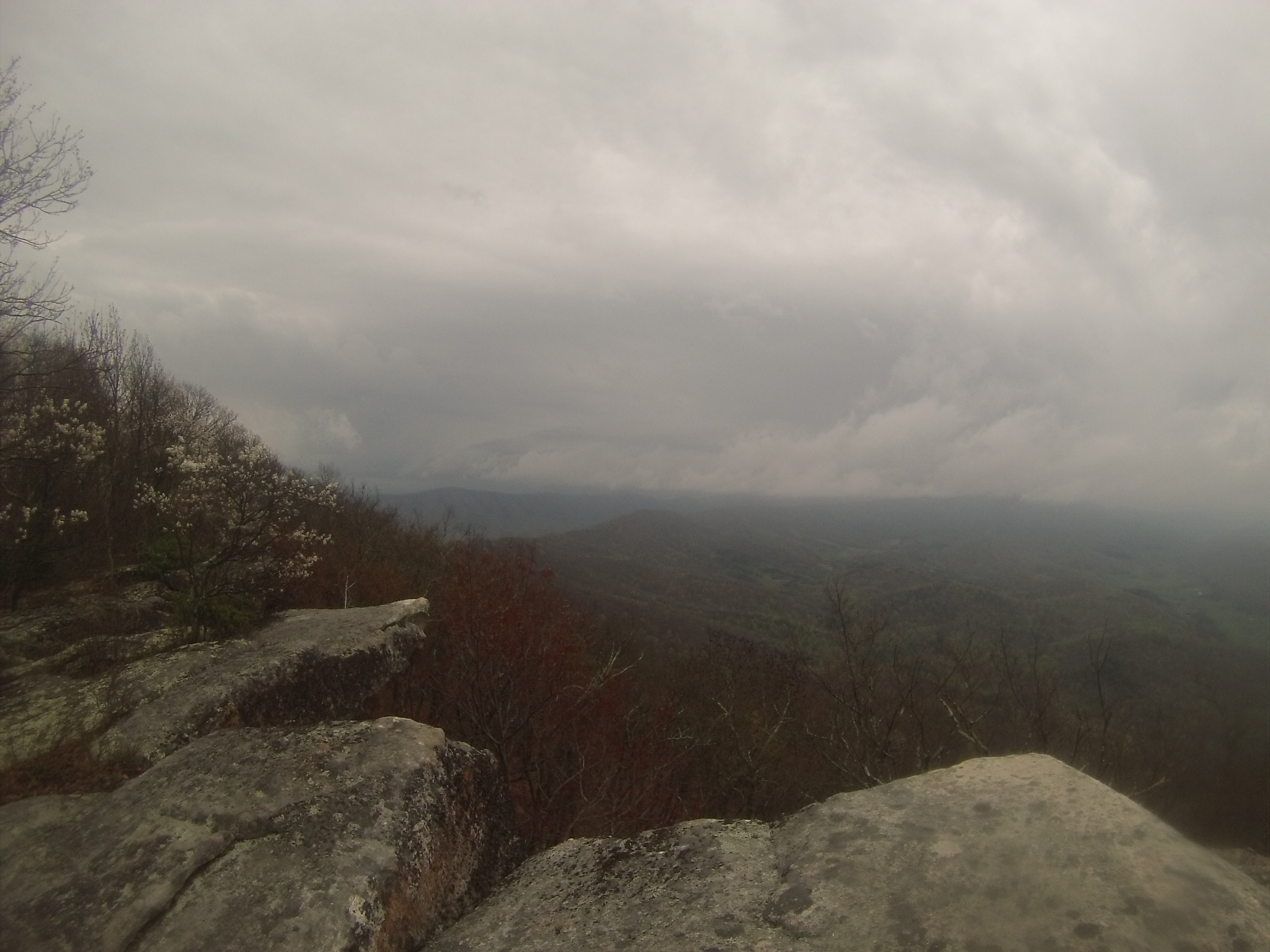
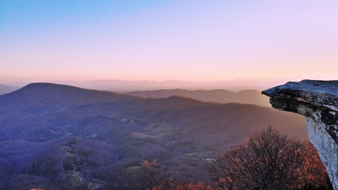
Once at the top a wide, boyish grin spread across my face. No picture I ever post will effectively convey the beauty spread out before you from this ridge. Layer upon layer of rugged mountains rise from the earth for miles, a dusting of snow coating them to accentuate the ridges and faces of the folds. The wind roared across the high peaks, and I closed my eyes while sitting on a rock, attempting to absorb the raw beauty surrounding me. The Blue Ridge Mountains have an old-time, southern charm to them; it’s almost as if you can sense the centuries of life that has called these hollows and highlands home. I was only at the very beginning of the ridge though (which is where most people stop), and I had much more to see.

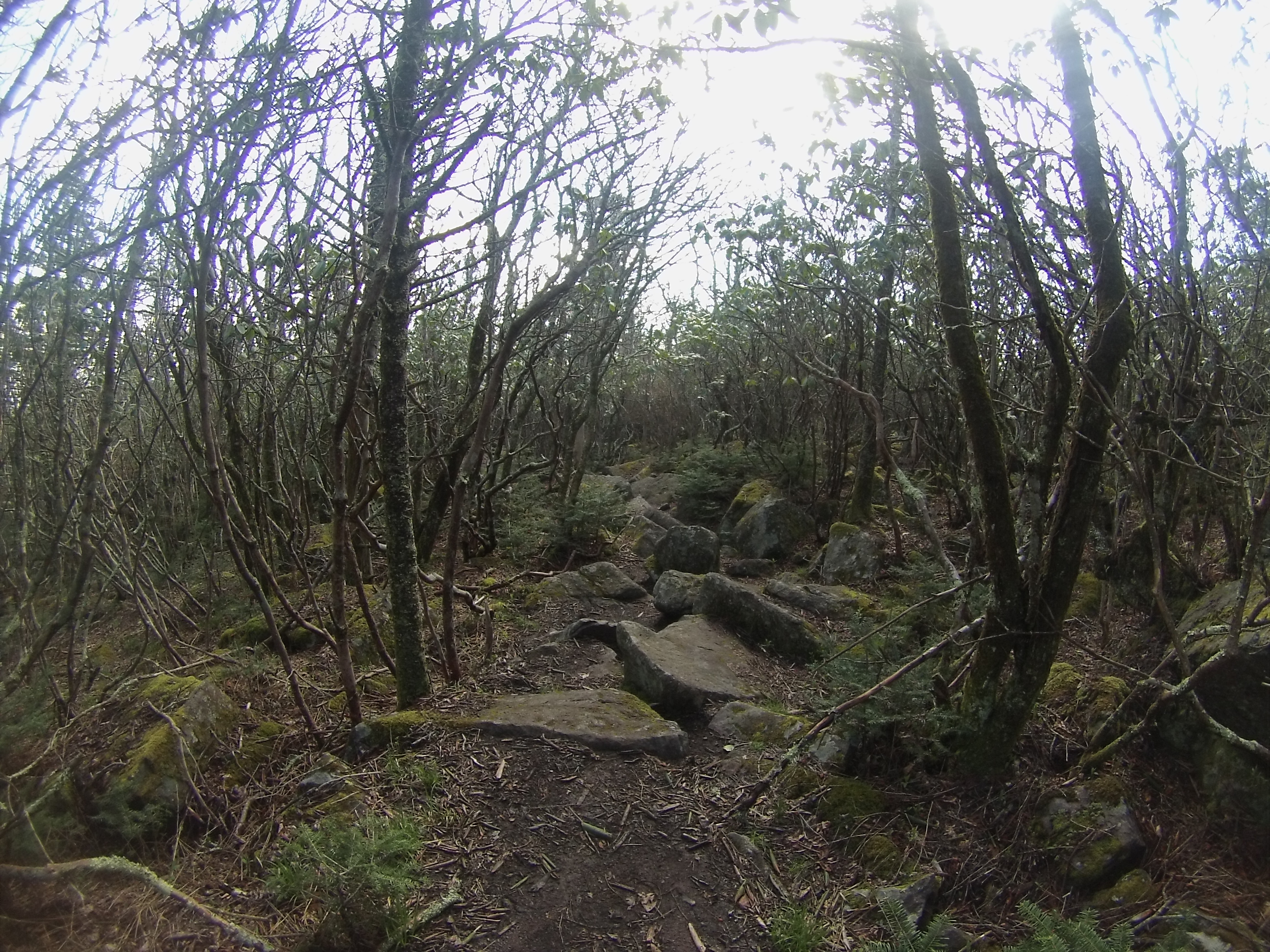
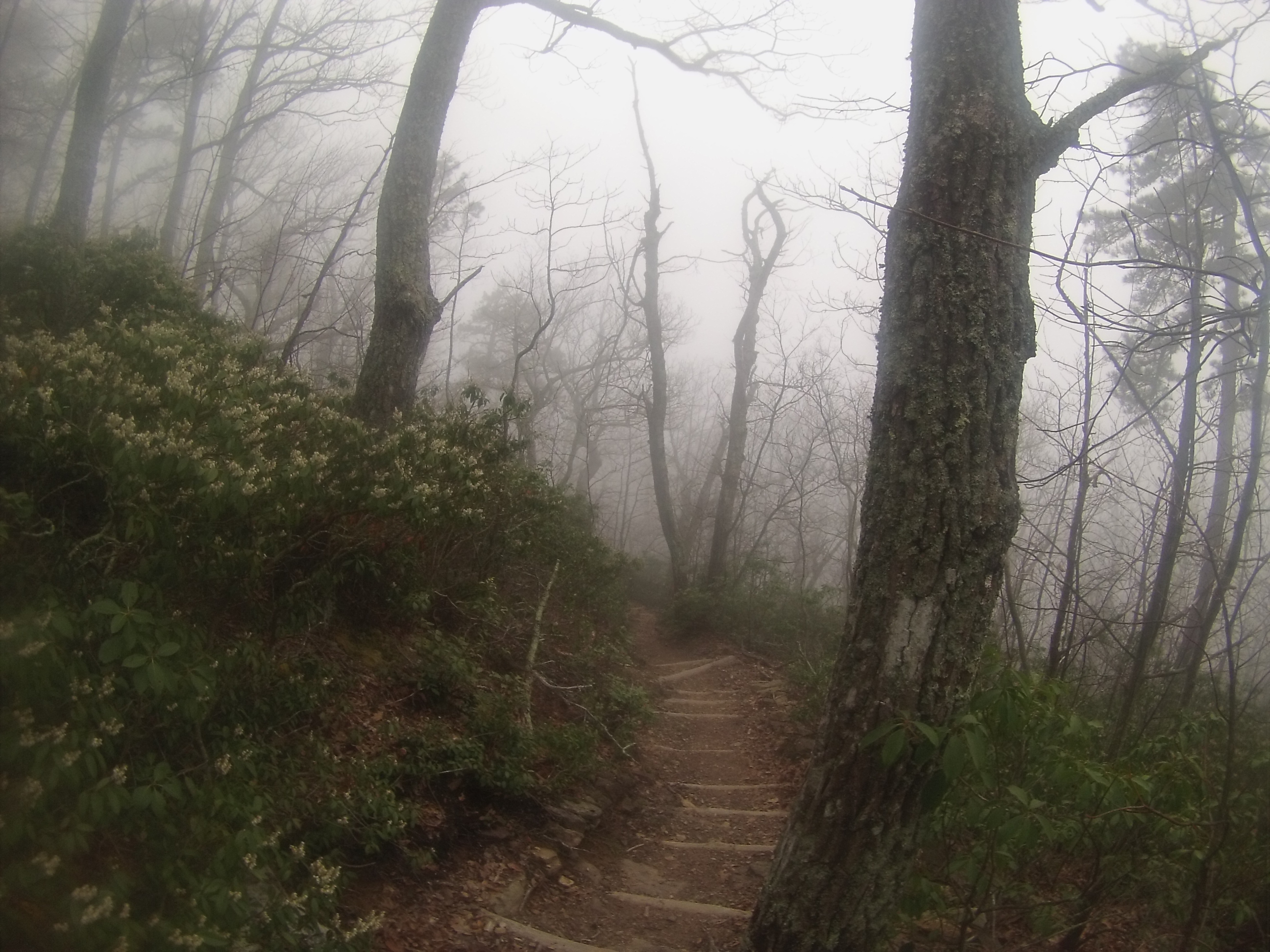
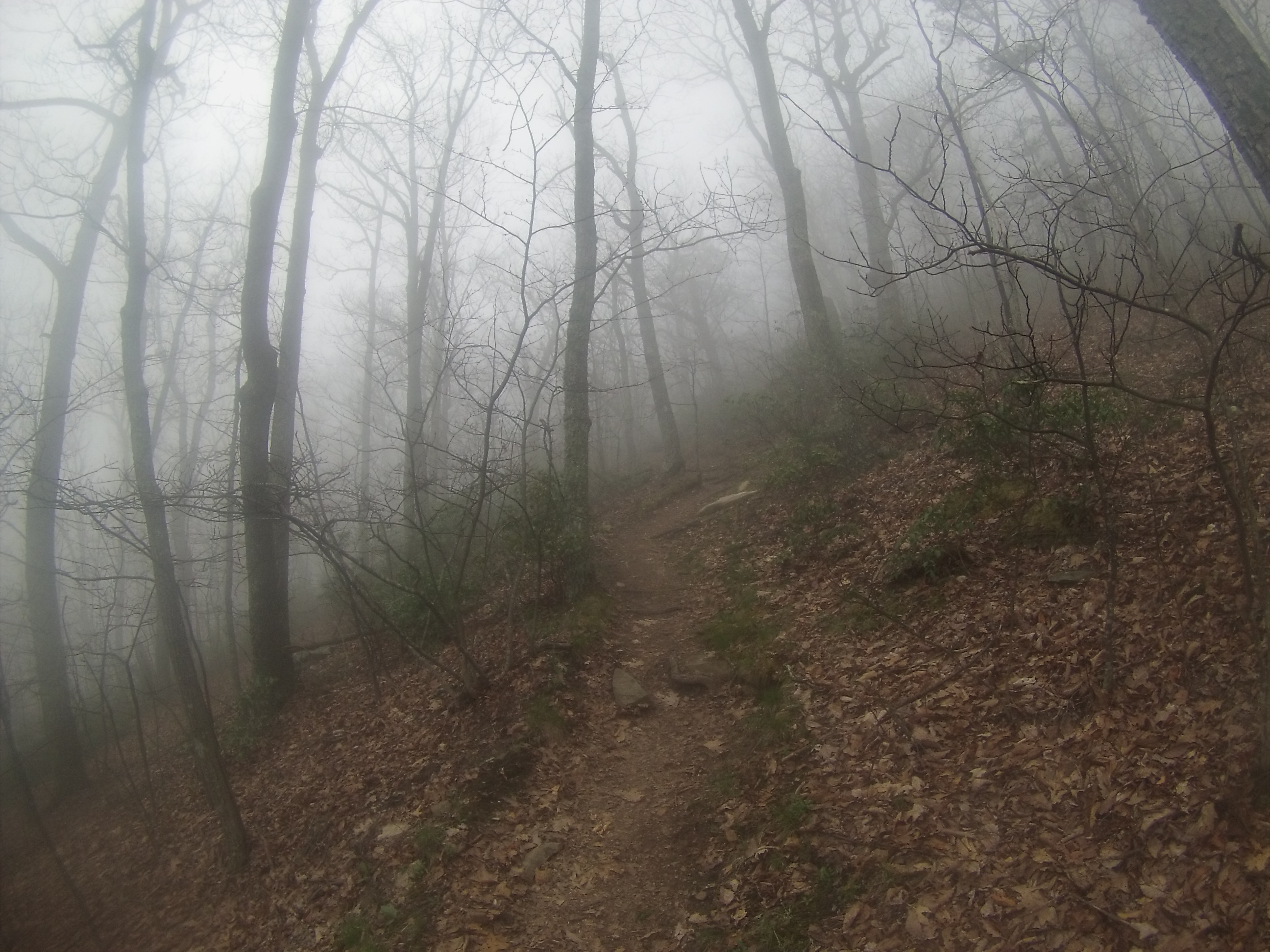
Walking down the well-worn trail once more, I began to descend into the tree line. The snow was hidden from direct sunlight here, and the drifts were still surviving. A few missteps saw me sink straight to my knees, which soaked my feet because I was wearing my Salomon trail runners instead of boots, but I had on SmartWool socks so I wasn’t overly worried. After a mile of walking through dense bushes and attempting to avoid sinking in the snow, I ascended again and was walking along the rocky ridge. I was looking for a place to camp, but I couldn’t find anywhere suitable; everywhere was either covered in snow or was bare granite. As I reached the crest of the ridge, though, I saw a small game trail that followed the spine of the ridge down to the valley and decided I would follow it for a bit.
image

I had to grab onto the bare bushes that dotted the face of the mountain, because it was still covered in patches of snow and I had no desire to slide down the mountain with a pack on my back (or without one, for that matter…). After descending 500 feet I stumbled right onto a flat area six feet by five feet that was free of snow and was covered with a thick layer of grass. The spot was perfect, so I set my pack down and leaned against a rock that resembled a recliner. This would eventually be where I camped that night, though I didn’t know it then.
image

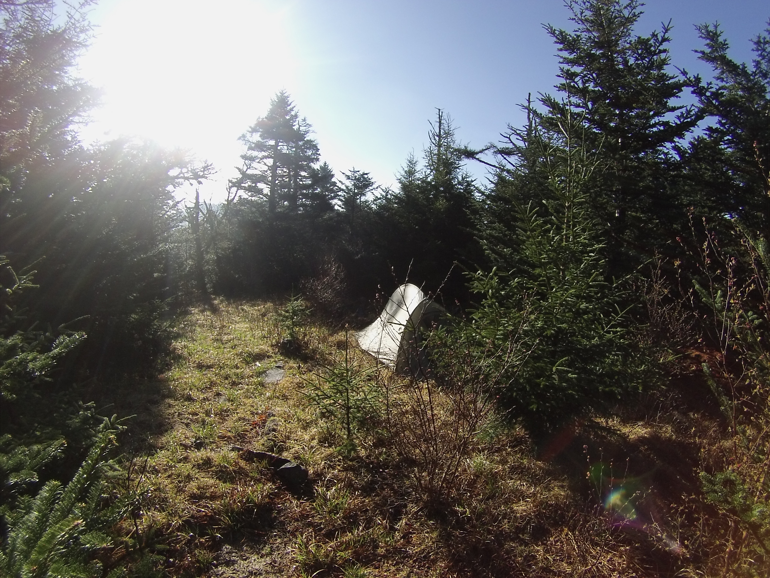
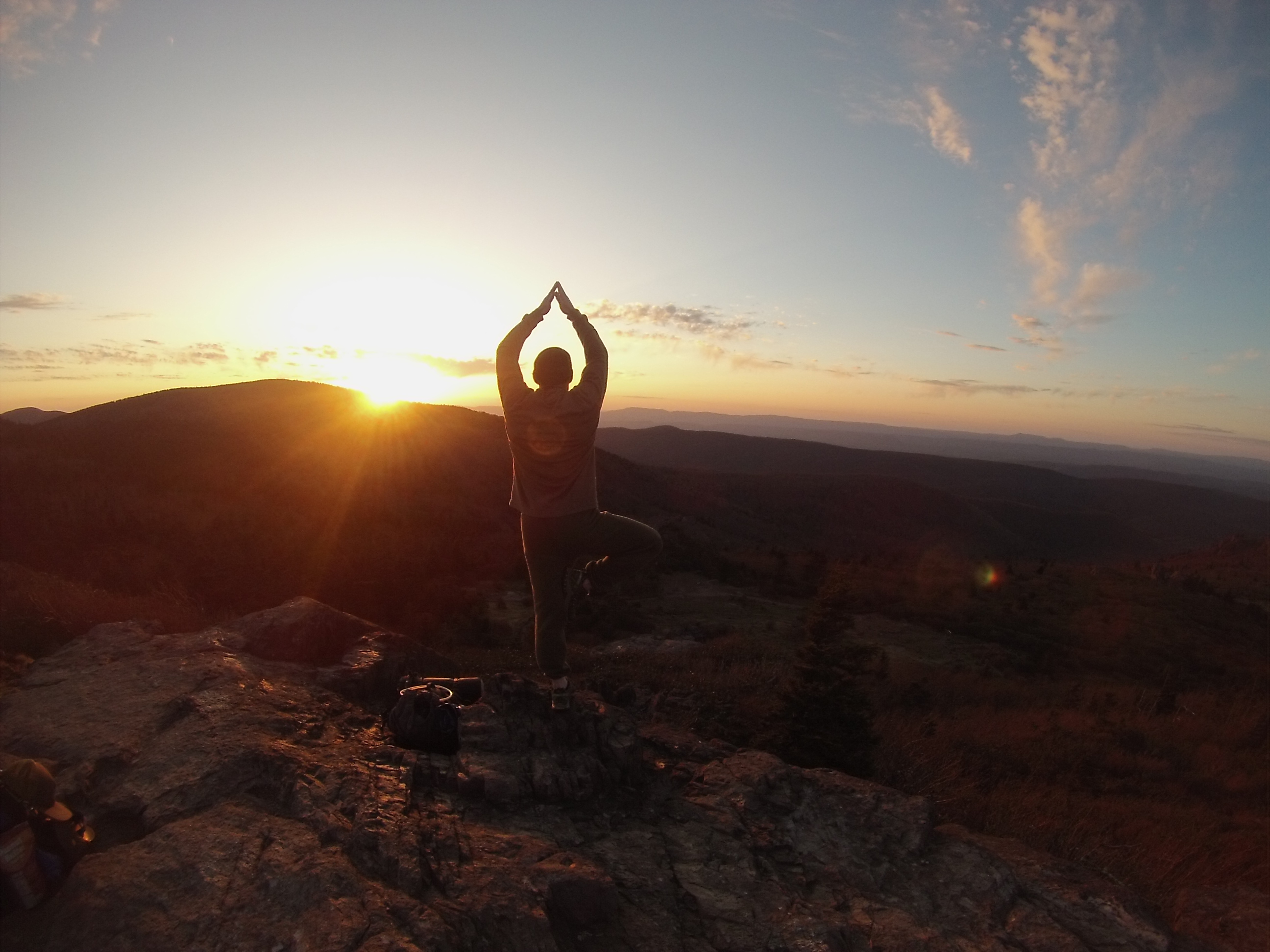
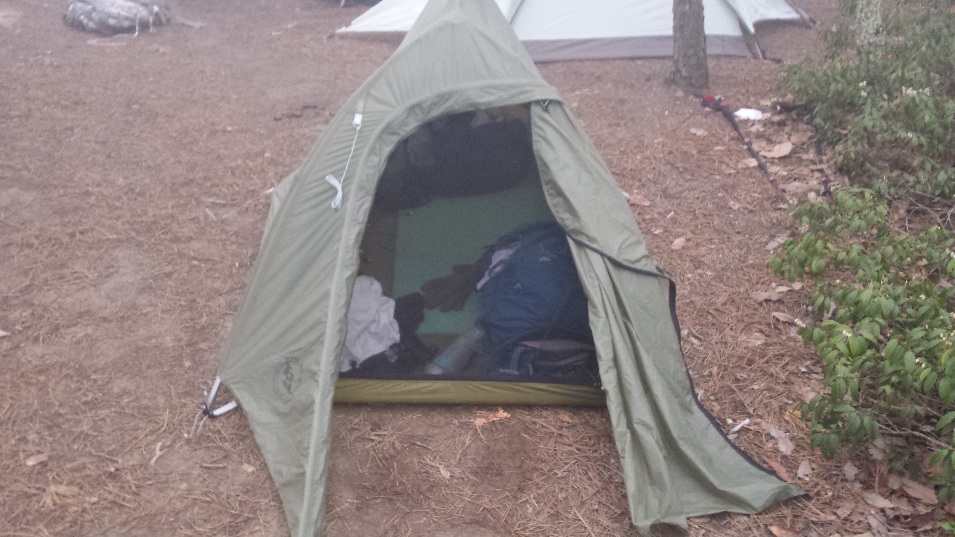
After eating some snacks and taking a nap I decided to get up and go explore some more. I climbed back up the steep face of the mountain and wandered around the top of the ridge for several hours, talking to people and taking pictures for groups. Once the golden hour began and the sun started its slow procession out of sight I figured I should actually find a campsite. It took me forever to decide on a spot to pitch my tent, because I always want the best views possible and I like to explore all of my options. This location made me compromise: did I want the best views or no wind? I chose the best views, but as it turns out my choice didn’t matter. With thirty minutes until the sun was completely gone I began to pitch my tent, only to find that the ground was still too frozen for my tent stakes to penetrate it. Great!
image

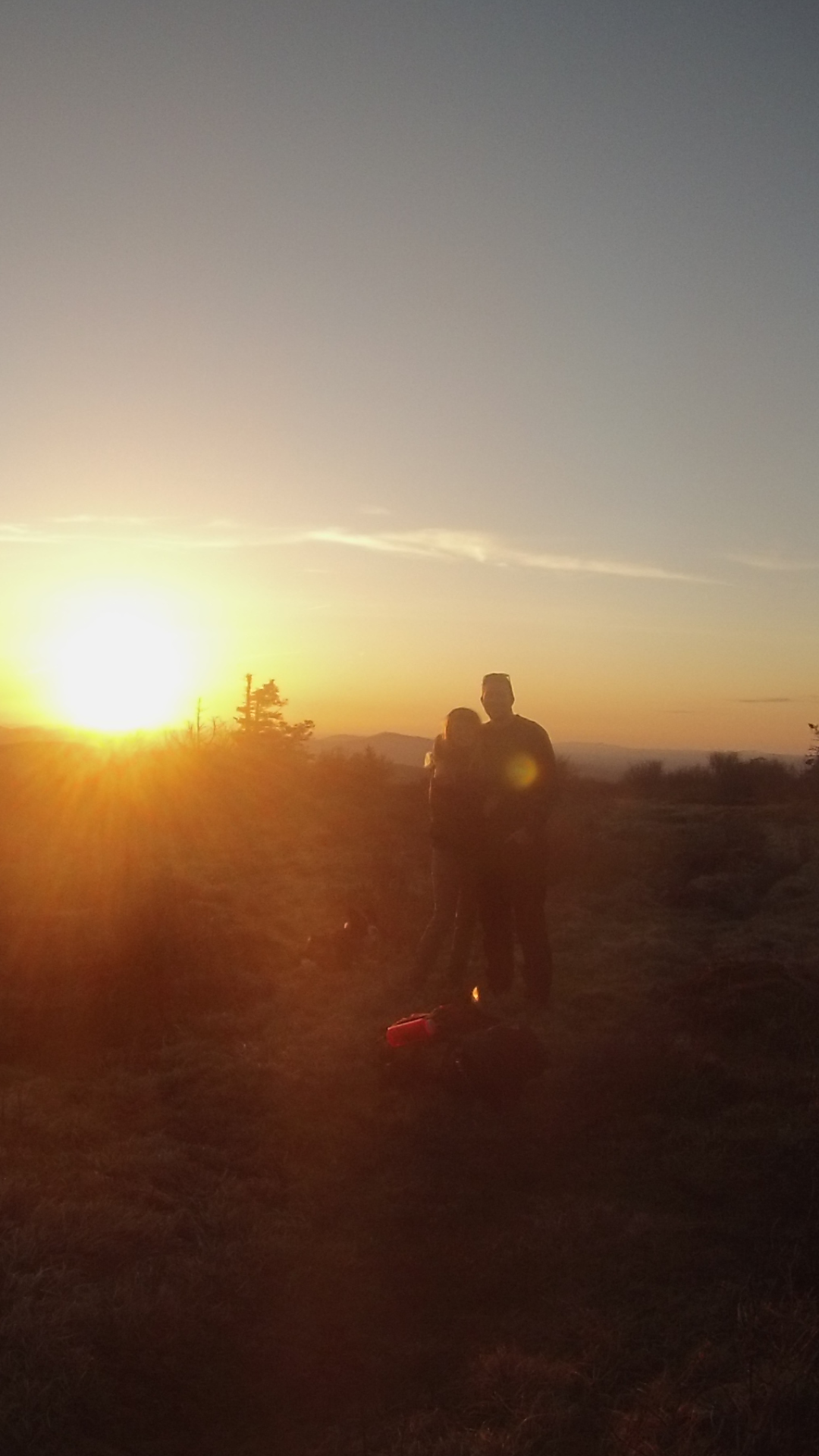
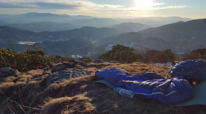
As luck would have it though, I knew that there was a zero percent chance of any precipitation that evening. I weighed my options, and after about thirty seconds of deliberation I decided to make haste back to the spot I napped in earlier. I’m not entirely convinced that my tent would fit on this little pad of grass, but that wasn’t my plan anyways. The sky was clear with no chance of rain (or snow, at this elevation), and I was going to cowboy camp. I got to the spot just in time to quickly unpack and set my sleeping bag up, take a few pictures, and finally hop in the bag to warm up and watch the sun set.
image

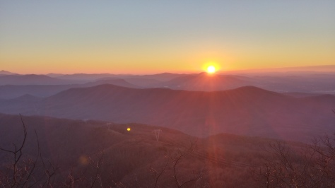
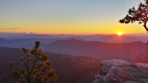
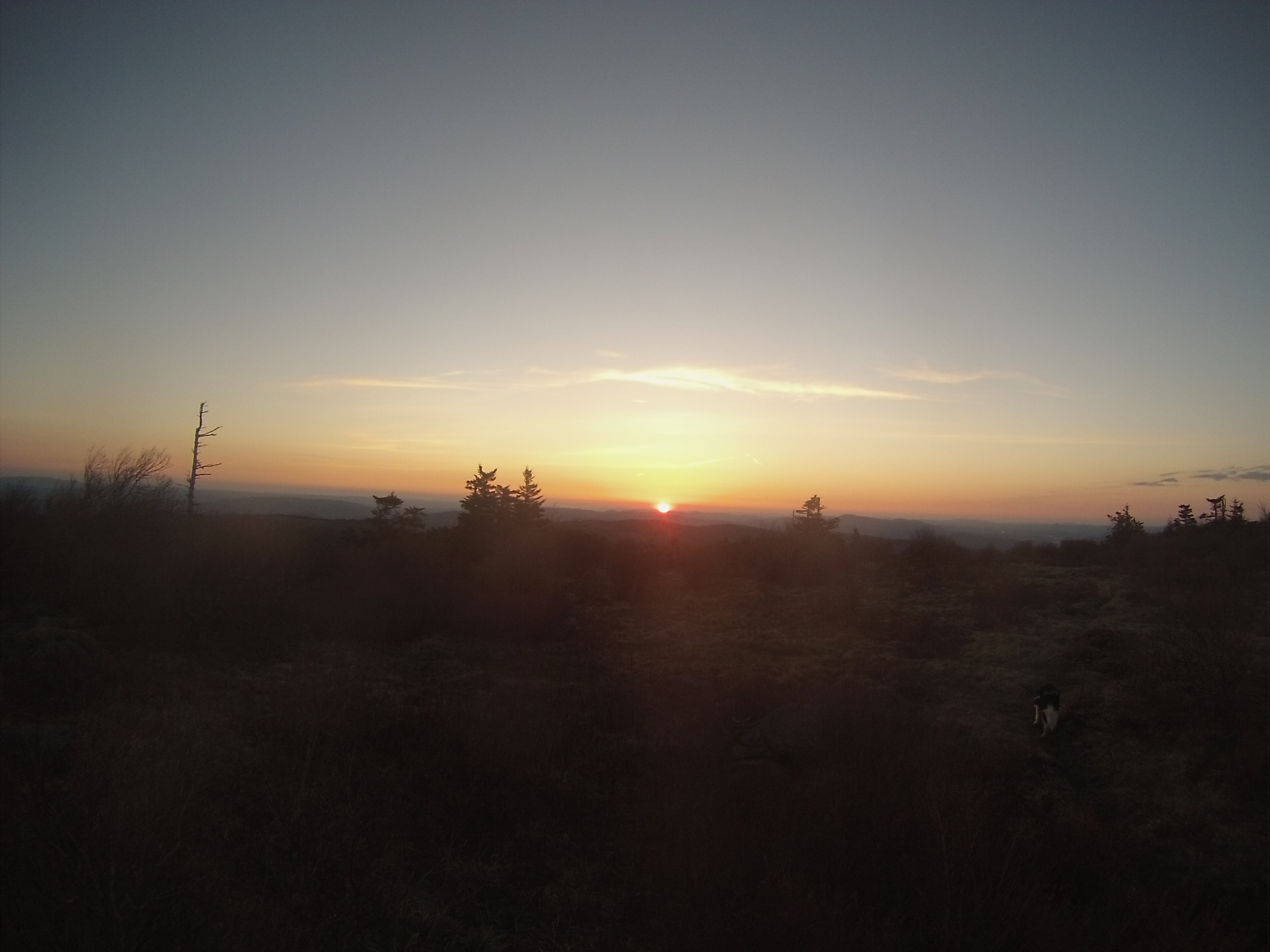
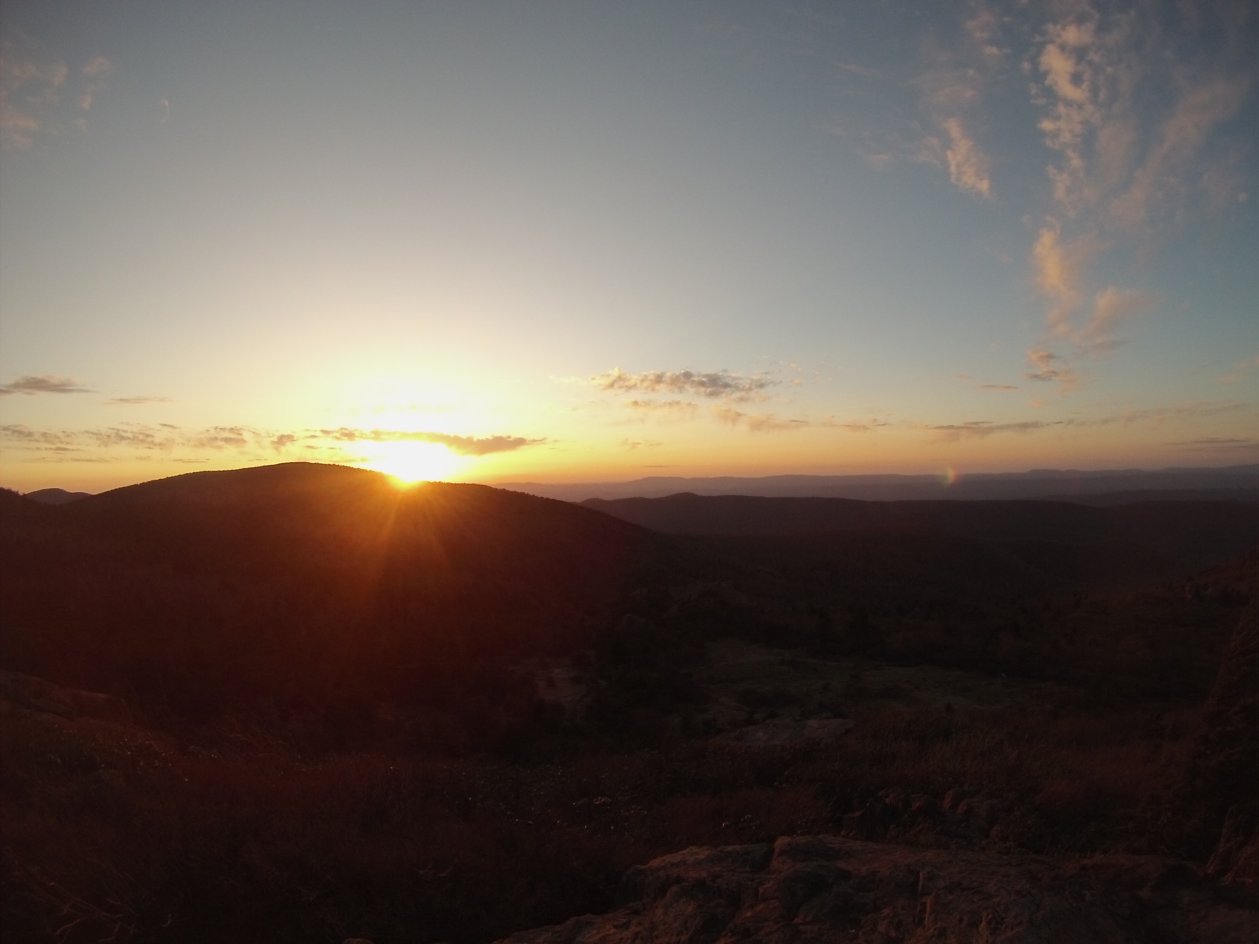
I’ll admit that I was slightly worried about the wind, as I was only protected by a few bare bushes, but there weren’t many other options. At any rate, the spot I chose had 270 degree views of the mountains, so I was okay taking the gamble. The temperatures dropped with the sun, but the views got even better. Hues of orange highlighted the tops of the mountains as the sun sank behind them, shadows grew longer, and the stars began to make their nightly appearance one by one. I would have loved to stay up and stare at the stars, but I was actually pretty tired, so instead I yanked on the drawstrings of my Marmot sleeping bag and enjoyed the warmth that the 15-degree, 650 Fill Power Down bag provided as I passed out. I woke up every two or three hours throughout the night and tried to find constellations in the sky, as it was absolutely clear, but I never learned any of them besides the Big Dipper so I was really just admiring the beauty of them all.
image

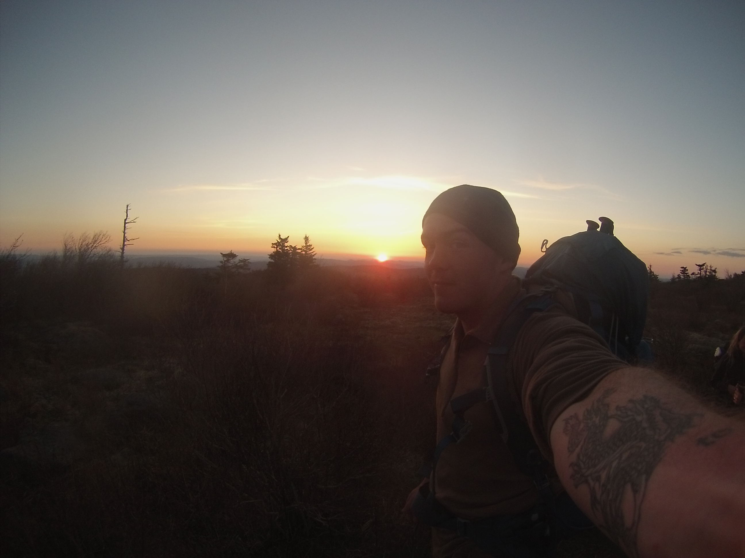
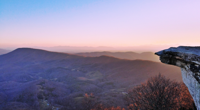
My ride was going to pick me up at 9 am the next morning, so I woke up at 6:30 like I normally do, and laid in my bag waiting for the sunrise. Slowly, the light began to grow, and you could clearly see the progression of colors on the horizon from a deep, dark red to a stately and majestic blue (if you were taught R.O.Y. G. B.I.V. in elementary school as the colors of the rainbow, imagine this and you can see what I’m describing). As the sun rose to greet me at the top of the mountain, I began packing and headed back towards the parking lot, 5 miles away. I took my time, reveling in the beauty with every step that I took (though a lot of the speed had to do with me descending a steep, ice-covered trail), and meandered my way across the mountain tops. Knowing this would be my last time on the trail until this summer, I got a bit sad and sat on a rock at the end of the high part of the trail for a few minutes before continuing on.
image

I didn’t see another soul on the trail that morning until I got to the parking lot, and that is exactly the way I wanted it to be. It must be an anomaly to have such a famous spot to yourself on a day that gorgeous, but I’m not complaining. I was able to soak in every last bit of beauty around me without any distractions, and end my trip to one of my favorite spots in the perfect way.
image
image

image

image

image

image

image

image

image

image

image

image

20160130_171447.jpg

New Beginnings

1451866746894
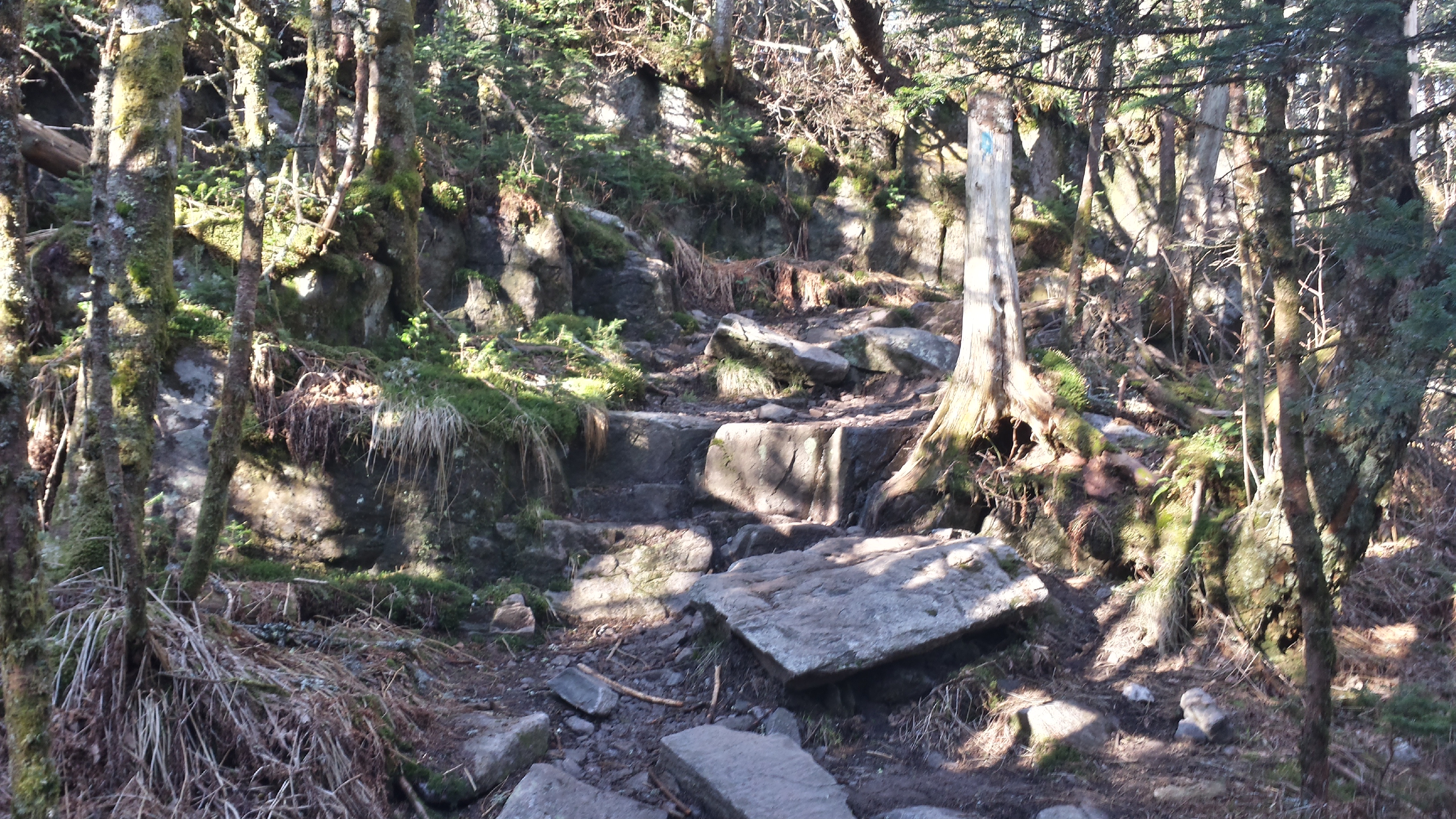
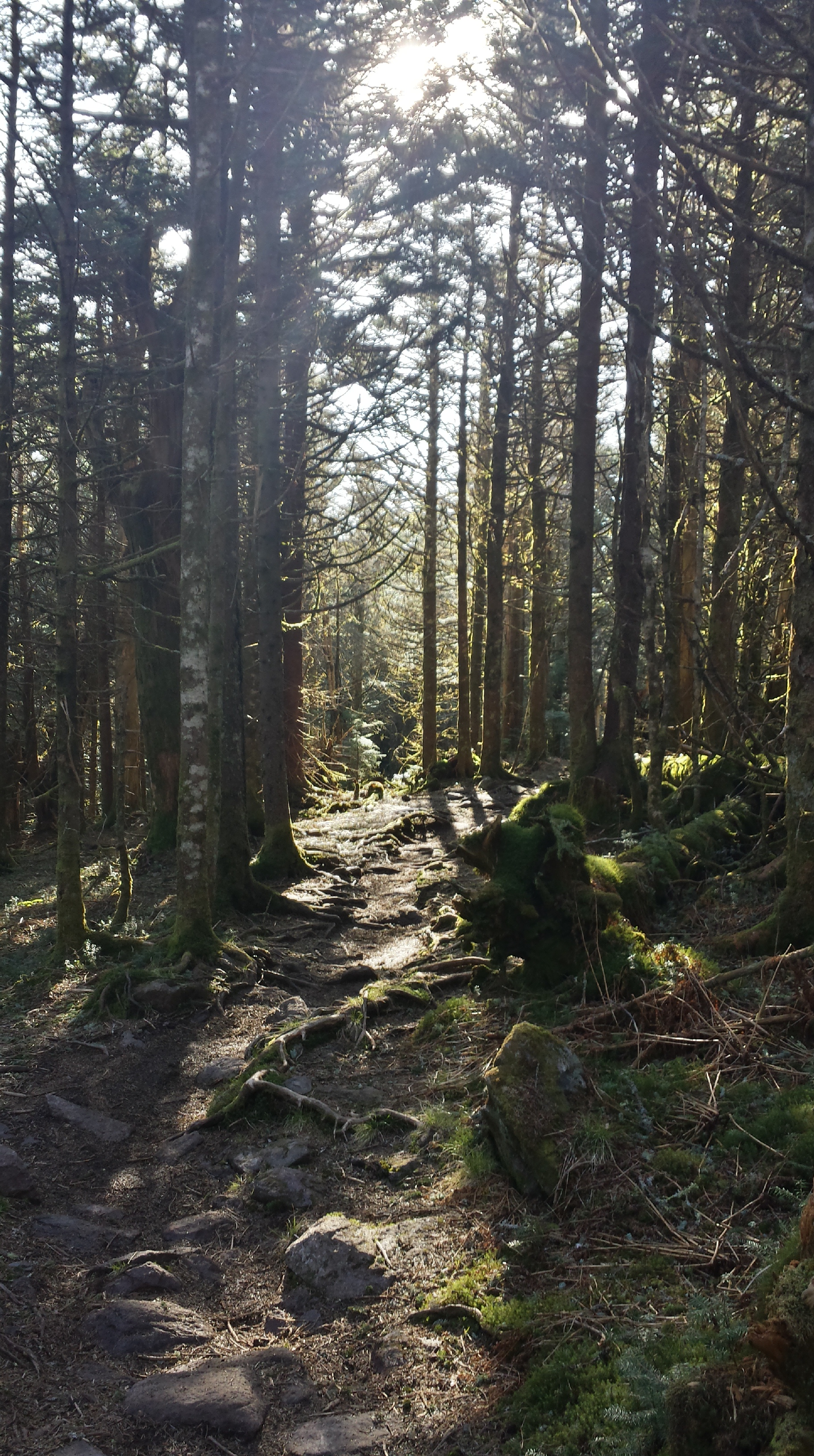
It’s been a while since I have written anything about a trip I’ve taken. That’s not because I haven’t been on any, I just haven’t felt like writing… oh yeah, and WordPress deleted a 1700 word post I wrote about the Roan Highlands! Since my last post I have been to New Hampshire to hike in the White Mountains and visit with family, North Carolina, Tennessee, and of course my adopted state of Virginia. This post isn’t going to be about any of those. Instead, it is going to be about my most recent trip (which happens to be the one I cherish the most).

I’m on my Christmas break from school right now and, as the days dwindle until it resumes, decided I needed to get at least one last trip in. I started scouring the internet for weather conditions in Virginia, trying to find some pleasant weather, but, despite the rather warm winter we have been having, everywhere I looked was going to be below freezing at night. This isn’t a problem for me, but I wasn’t the only person who would be going on this trip.

20160102_091725_Richtone(HDR)


On this occasion I would be bringing along a wonderful woman I have been seeing for a while. With dark hair and blue/green eyes (they change), a go-with-the-flow attitude, and a beautiful smile, she makes my heart skip a beat every time I am with her. She is beautiful inside and out. However, she has never been camping in a tent. I had to show her how wonderful it is, so of course I chose one of my favorite spots in Virginia: McAfee Knob.

20160102_073517_Richtone(HDR)

I was initially worried about the weather because she gets cold easily, and it could definitely be argued that I should have just waited… but I wanted to make a memory like this together sooner than later. Besides that, can you think of a better way to bring in the New Year? That’s a rhetorical question, don’t answer it. So I asked her if she would like to come, she said yes, and I began planning.

20160101_085722_Richtone(HDR)
I borrowed the camouflage Arc’teryx pack, and Maggie used my Osprey Atmos 50

I had to borrow a pack from my buddy, and some wool blankets, but other than that I had everything we needed. We left my house at around 10:30 a.m. and headed south to Roanoke on a, surprisingly, mostly empty I-81. 81 is notorious for being packed with 18-wheelers, who have no problem driving side by side at 20 mph under the speed limit, so that was a real blessing. We got to the Catawba Mountain parking lot on VA 311 pretty quickly, and started up the mountain at 3 p.m.

Clouds were covering most of the area we were hiking in, so it was overcast and chilly, but we still had to stop and take breaks because we were sweating. There really wasn’t a happy medium in layering and rate of travel to be comfortable while still hiking fast enough to be at the Knob for sunset. So, we marched on, and made it to the world-famous vista fifteen minutes before sunset. By then, the clouds had somewhat cleared and we were able to snag some good pictures, but we didn’t stay long. Our destination for the night was the Pig Farm campsite, .6 miles north on the Appalachian Trail.

20160101_164300_Richtone(HDR)

I really am proud of Maggie. We got to the campsite right as the final rays of light were ebbing away, and it was getting even colder. She helped me set up the tent (Big Agnes Seedhouse SL1), and then started gathering sticks to make a fire. There were really only twigs around, which don’t go far when you want to warm up, but she made several trips all around the area to find them while I set camp up and got dinner ready. I don’t want to say that this surprised me, but it sure makes me smile when I think about it.

After our attempts (with copious amounts of lighter fluid) to turn the damp twigs and leaves into a roaring fire, we decided to just eat our dinners and get in the tent. Normally I bring Mountain House meals for each meal (I still did for breakfast), because they are tried and true, but this time I went with the more expensive “Good to-go” brand and brought a Thai Curry and Herbed Mushroom Risotto. I was introduced to the Thai Curry from “Good to-go” by some friends I met while camping in the Grayson Highlands, and I think they taste a bit more like real food.

20160101_170251_Richtone(HDR)

We could hear the wind howling most of the night; it was louder than any wind I have ever camped in, and for a minute I was worried that it might collapse our tent. We were very warm though, because we probably had ten to fifteen pounds of sleeping bags and blankets under and over us. We used two sleeping pads (my closed-cell foam pad, and an inflatable pad), my Kelty 35-degree synthetic bag (which we draped over the pads and laid on), my Marmot Sawtooth 15-degree down sleeping bag (we unzipped this and used it as a quilt, with a Nalgene full of boiling water covered in a wool sock by our feet), and laid the two wool blankets over all of it. It almost felt like a summer night in the tent, we were so warm.

The next morning we got up and packed my Osprey Atmos 50 pack with some water, snacks, and the two wool blankets (it was still 25 degrees) before making the .6 mile uphill trek to the Knob again to watch the sunrise. We made it a few minutes before and were in awe once we got to the cliffs, from which we would be watching the sun make its appearance. The howling wind from the night before had removed any trace of clouds from the sky, leaving the horizon so clear that you could see the transition of colors from the dark red just visible over the mountain tops, to the deep blue of the sky.

1451861723049

I like to think that I know exactly what I’m doing, and I do most of the time, but there was one thing that really could have made the trip better. I use IsoButane fuel canisters to boil water in my JetBoil, but because of the cold the fuel would barely feed to the ignitor, and I couldn’t get the water to boil in the morning. It didn’t seem like that big of a deal, but we still had 5 miles of hiking to go before we got back to my truck, and a hot breakfast really would have been nice. My ego got put in its place, which is probably a good thing, and Maggie saved the day with the almonds and other mixed nuts (and slim jims) that she had brought.

Once we got back to the truck we made a beeline for the nearest Waffle House and gorged ourselves upon copious amounts of scrumptious, greasy food before getting back on the road. The destination for the afternoon was the Inn at Old Virginia, a beautiful and charming bed and breakfast in Staunton, Virginia. Not wanting to be on the interstate again, we elected to take back roads to Staunton since it was such a sunny day, and were rewarded with rolling hills of farmland and mountains in the background.

20160103_113916_Richtone(HDR)

The Inn is a few miles outside of Staunton, and is absolutely gorgeous. The staff there is very pleasant and helpful, and the owner is a real sweetheart of a lady. There is a main house with some rooms in it, which has a library with elegant leather-bound books in it, a dining area inside of what I think was a greenhouse, and “the barn”, which is a short walk from the main house and has been renovated with beautiful rooms. Ours even had a private porch from which we watched the sun rise in the morning again. If you are in the area and looking for a nice, romantic place to stay, I would not hesitate to recommend the Inn at Old Virginia.

20160103_074050_Richtone(HDR)
Sunrise from our private porch

After a breakfast of french toast, bacon, and a fruit bowl, we decided to drive south to the Raven’s Roost overlook on the Blue Ridge Parkway. This particular spot has been recommended to me by several people, and it is only 10 miles down the parkway, so we decided to go. It was very pretty, but I think I would rather go when it is warmer and the wind is not blowing in my face. We took our photos and then went to get back in my truck, when a car pulled up behind us. This is pretty normal, as people stop to admire the beauty of the Blue Ridge mountains at the many scenic overlooks, but a couple got out of the car and asked us to take a picture for them. I obliged, and as they walked over to the ledge and posed for the picture the lady said, “do you think we should tell them?” This really got my imagination running… Tell me what? Are you axe-murderers? Are you going to try and rob us? No, it was something much sweeter. She smiled at the man next to her, looked back at me, and said, “we just got engaged thirty minutes ago.” I’m a total romantic, so that brought about a goofy grin on my face and I started congratulating them. But my hands were numb from the cold by that point, so I took the photos and got back in the truck. It was really nice to see though, and the guy picked a perfect day to propose in the mountains.

20160103_114051_Richtone(HDR)

Driving back north, we decided to get some food and then hopped onto Skyline Drive, choosing to take the scenic route again and enjoy our time together. We talked about serious things, funny things, and took in the beauty of the mountains while heading back to Fredericksburg. Maggie isn’t afraid of silence, which I really appreciate, because sometimes it’s nice to hold hands, stare down the road and drive, and smile at each other because we are both having an amazing time. I was a little worried that she might not want to go on any more trips with me after all the cold we experienced, but she still wants to (though, maybe in warmer weather, which I agree with).


We brought the New Year in the best way I know how: sleeping in the woods and watching the sun rise in the mountains. Oh yeah, and did I mention we are in a relationship now? It’s Facebook official. I hope whoever has managed to read this novel (I promise I didn’t mean for it to be this long) started 2016 doing something they love, and in good spirits. Here’s to new beginnings.

IMG958526

Grayson Highlands

DCIM100GOPRO

In September the section I work with had an essay contest over the 14 Leadership Traits in the Marine Corps. The essays were to be written on which trait you think is the most important, why and what you as an individual can do to further the chosen trait. The winner would receive a day off from work in conjunction with a weekend of their choosing. I elected to write about “unselfishness”, and won.

Fast forward seven months.

It’s Thursday afternoon and I was checking the weather forecast for the weekend so that I could go backpacking. Usually I go to Shenandoah National Park because it is somewhat close to Quantico, but the forecast called for rain on Saturday. I decided to take my day off the next day and head five and a half hours south, to the Grayson Highlands, which are famous for their breathtaking views and wild ponies.

20150503_072600_Richtone(HDR)

Back in the early 1900’s the mountains were logged and rendered bald. Wild ponies from Assateague and Chincoteague Islands off the coast of Virginia were introduced to graze on the mountains and keep them free of trees and shrubbery. The result was a State Park with some of the most beautiful scenery on the east coast.

20150503_071341_Richtone(HDR)

I got to Grindstone Campground, in Grayson Highlands State Park, at about 4:00pm on Friday, changed into my hiking clothing, and hit the trail. My destination for the evening was roughly eight miles away, at the Thomas Knob Shelter along the Appalachian Trail.

Hiking up the trail was relatively normal at the lower elevation, with a well-worn trail and flora beginning to become green again. Once I got to the higher elevations, however, it got even more interesting. I was hiking in thick fog, creating a spooky yet peaceful environment for a solo-hike, and once I reached 4,000 feet Spruce-Fir forests began to take shape, while the trail steadily become more rocky and small springs began to permeate the trail.

I reached the shelter at 7pm and set up camp for the evening in a small clearing a few yards from the Appalachian Trail. The fog had receded some, but I couldn’t watch the sunset because it covered the mountains for the most part. That night I didn’t get much sleep, between the ponies romping around my tent and the moon shining inside of it.

DCIM100GOPRO

I woke up at 6am Saturday morning to watch the sun rise, but the fog was swirling thickly and reduced visibility to twenty feet. I decided to get some more sleep, and got back up at 8:30am, made coffee in my Jetboil (with the Java Press, an excellent addition for any coffee connoisseur) and broke camp.

Walking through the forest along the ridgeline, I encountered the first group of wild ponies half a mile down the trail. You would expect the ponies to be spooked by humans, but since the Appalachian Trail passes directly through their territory they are used to humans feeding them, and will walk straight up to you. The first pony that approached me began licking my arm to get the salt from my skin.

DCIM100GOPRO

After leaving the ponies to continue my hike, the trail devolved from forests and wound its way through some tall shrubbery. I was looking for the Pine Mountain trail, which I had read about on the internet. I completely missed the trail, but fortunately another hiker had just passed a small sign and pointed me in the right direction (and is now following me on instagram; isn’t social media great?).

Hiking on the Pine Mountain trail brought about even rockier terrain, as the trail descended towards the bald sections of the park. I love hopping from rock to rock, so I had no complaints, though I passed a heavier set man who had twisted his ankle on a particularly rocky section. After seeing a clearing in the woods to the right, along with a sign for another trail, I switched to the Crest Trail.

DCIM100GOPRO

The Crest Trail is essentially a shoal road that you would find on a ranch back in Texas. There is also a massive amount of horse crap, because the Grayson Highlands have some of the most scenic trails for horse riding in the state. The views do not disappoint, since the trail follows the crest (imagine that!) of a mountain, and offers up many points to stop for a break cleverly disguised as a photo op.

5 miles of walking into the morning I reached Scales. Scales is a huge corral, with a privy, park maps and a spring located inside it. Scales is also the place where a portion of the wild ponies are herded every September and sold at auction. It is located at a gap in the mountains, and is a huge intersection for trails, including the Appalachian Trail and the Virginia Highlands Horse Trail.

My plan was to hike four more miles from Scales to the Old Orchard shelter along the Appalachian Trail.  Then I ran into the Boy Scouts.

I am happy that organizations such as Boy Scouts exist, but not near me. This particular troop consisted mainly of 10 year-olds, and they were obnoxiously loud. When I’m hiking I don’t want to be around a bunch of young kids yelling every thirty seconds, so I changed course and headed down the Virginia Highlands Horse Trail.

The Horse Trail was rated high on hikingupwards.com by a fellow hiker, but I turned around after the first mile of it, as it descended into the valleys, and I had soaked my shoes three times already (the trail was essentially a small stream of water and horse crap). I hiked off of the trail to the right and began bushwhacking my way back to the Crest Trail.

After a few miles I ran into three hikers at the intersection of the Crest Trail and Appalachian Trail. One of the men was a Navy Corpsman in the seventies, and struck up a conversation about the Eagle, Globe and Anchor on my shirt. After shooting the shit for ten minutes they invited me to eat lunch with them, so I accepted.

One of the beautiful things about hiking is that people tend to be more pleasant and open to talking with strangers. We talked about everything from time in the service (the two older men were in the Navy and Army) to different trails we had hiked. We eventually arrived at the topic of alcohol, with me telling my experiences and talking about how I was sober now, and they told me of their struggles after the service. One of the men had been a burnout for several years after separating from the Army, but got his act together and is now a doctor conducting brain research. It always amazes me how far you can go if you put down the bottle and apply yourself!

After we parted ways, I decided to head back towards the Thomas Knob Shelter, as it has great views when the skies are clear. I had no idea where I was going to set up camp, but wandered onto the most amazing panorama of mountains and valleys I have ever seen.  I was going to set up camp on a random clear section of trail, but ran across a few perfect campsites in the tree line right off of the trail.

20150503_075310_Richtone(HDR)

After picking a spot and setting up camp, I noticed that there was another camp a few yards away. Having brought no lighter, and wanting a fire in the evening, I walked over and asked where the nearest spring was and if the guy had a lighter to spare later on. That turned out to be one of the best decisions I made that whole weekend.

As it turns out, the people camping next to me were celebrating their one-year anniversary of being married in this gorgeous park. I congratulated them, and then got invited over to eat dinner with them and their dog, Hilo (rhymes with kilo).

DCIM100GOPRO

They were awesome. We talked about where we were from (they were from Tennessee) and what we liked to do. It turns out that Julian is an avid mountain biker, and outdoor enthusiast, who has been coming to this spot with his dad since he was seven. I was honored to be able to share the spot with them. He also knows the names and silhouettes of a lot of mountains. Since visibility was great that day, we were able to see Rocky Top, which he pointed out and told me was about 105 miles away.

After telling them I am from south of Houston, Julian told me he works at Dow, and they have been trying to get him to Freeport for a while. What are the odds! We both agreed that Tennessee would be a much better fit for his family.

Their dog, Hilo, was full of energy and loves to fetch and catch frisbees (he is very good at that). While we were throwing the frisbee for the dog I mentioned that my dad has had Vizslas since I was little and I really want one of my own. When I tell people the breed of dog I want they usually reply with, “what’s that?” But Julian told me he wants one too! Two guys who both want vizslas, in the same campground, what are the odds?

20150503_070850

After we ate our dinner, which consisted of some dehydrated backpacking meals (and half a block of some awesome cheese they gave me), we all walked over to a rock called Little Wilburn to watch the sunset. Since it was their anniversary, I hung out for a bit, but opted to let them enjoy it alone and watched the sun set from another rock in the vicinity.

DCIM100GOPRO

There were a few other people where I was, all watching the sun set behind Mt Rodgers, and we made small talk. From a completely random conversation, I discovered that two of the guys had just finished a year at Liberty University and knew the people I randomly camped with at McAfee Knob two weeks ago! Coincidences abounded on this trip.

DCIM100GOPRO

That evening, after returning to camp and grabbing my headlamp, I decided to do some night hiking. The moon was full and the sky clear, so I didn’t need the extra light. I walked around two miles along the Appalachian Trail, passing ponies asleep in the fields, and up to the top of Big Wilburn where I nestled into a chair-like portion of rock and watched the valleys in the distance. I looked up in the sky at the stars and moon, and let my mind wander freely. Within thirty seconds I had seen two shooting stars.

I returned to camp and slept very warmly in my sleeping bag, due partly to the fact that my legs were bright red from sunburn and were radiating a nice amount of heat. I woke up at 5:30 the next morning, broke camp and fixed up some coffee, then headed to Big Wilburn to catch the sun rise with Julian, Erin and Hilo. We didn’t make it up Big Wilburn in time, but we were rewarded with such a gorgeous sun rise that it didn’t even matter. We took a few photos, exchanged information and said our goodbyes. Thanks for sharing your time with me guys, I had an amazing time.

DCIM100GOPRO

I started the hike back to Grindstone, and was enjoying the crisp mountain air and the smell of the fir trees when nature came knocking. The dehydrated meals and countless cliff bars I had consumed over the weekend came back to my mind, and I hurried off the trail a ways.

When I reached Thomas Knob Shelter again I came upon several thru-hikers. We talked about the trail and their favorite parts so far, and I told them of my upcoming thru-hike. A lot of people, one of the guys I was talking to included, complete the trail in roughly six months and always call me crazy when I say I’m starting a northbound hike in mid June. Usually it doesn’t phase me, but this guy really rented a piece of my mind for a while that morning.

After he had finished telling me that he wasn’t active and didn’t train for the trail at all, he proceeded to inform me that my attempt was doomed for failure, and that I couldn’t start off doing consecutive fifteen mile days. I bit my tongue and humbly said I appreciate his opinion, but my mind was firing off retorts. “I’m a Marine, I walk every day and regularly do 20 mile days on the weekend” is exactly what I wanted to say. But I didn’t. After a while I decided there was no good coming out of stewing over his negativity, and put it in the back of my mind.

Since it was on the way, I took the spur trail to the summit of Mt Rodgers, the highest point in Virginia at 5,720 feet. The trail up was stunning as I got in the woods; moss covered trees and rocks, roots consuming the trail and stray rays of light filtering through the canopy captured my attention. It was as if I stepped into a Tolkien novel and was walking through Fangorn Forest.

20150503_082704_Richtone(HDR)

20150503_082515_Richtone(HDR)

The summit is relatively boring and has no views thanks to being surrounded by trees, but I was not about to let that ruin my fun. I attached my Texas flag running shorts to a hiking pole, fashioning a makeshift flag, and posed with it at the summit.

20150503_084955

All in all, this was an amazing trip, and definitely the most beautiful I have been on. I hiked 32 miles, took over 400 photos and 12 videos, got sunburnt and cut, and managed to crack the screen on my phone. The people are what really made it awesome, though, and I am so grateful for each and every person I came across. I am now putting together a group of people in my unit to go back to the Grayson Highlands this coming Memorial Day weekend so that I can share another great experience with them.

Screenshot_2015-05-05-21-28-38

Julian, Erin and Hilo

1430667557098

Stinky, sunburnt, satisfied

McAfee Knob

DCIM100GOPRO

This weekend I got a rental car again. I told myself I was just going to hike on base all weekend, but Saturday morning that sounded boring. Off to Avis.

I decided (on the way to the rental office) I would drive down to McAfee Knob, near Roanoke, and try to catch the sunset. I had been there once before with my mom, but it was foggy and most of the views obscured. The estimated time to get there was 5:40 p.m. which would leave me two hours and fifteen minutes to hike the 3.9 miles to the knob and watch the sun set.

Life has a strange way of happening contrary to the plans I make.

I stopped at a gas station ten minutes from the parking lot to grab a few snacks, and ran into three guys that were currently on their very own thru hike. I was planning on making small talk about how awesome it is that they’re already doing the trail and moving along- I had a sunset to catch. The guys seemed pretty cool though so I hung out and talked for a while, eventually taking them to Kroger so that they could get their food resupply done. They told me it was nice trail magic (a term used by hikers to explain the timely food placed on the trail for hikers, a free room and shower, or meeting up with someone you haven’t seen in a month on the trail randomly), but I just wanted to help. One of them has a blog as well (mikesbighike.blogspot.com) Best of luck guys, and keep on enjoying the trail!

I finally got to the parking lot… at 6:25 pm. Most of my gear had been tossed haphazardly in my buddy’s backseat, and transferred in the same fashion, as I rushed to get to the trail in time for sunset. It took five minutes to organize everything and get on the trail.  Needless to say, I was worried that I wouldn’t make it in time for the sunset, as I only had an hour and a half to get there. I shouldn’t have been, though, because I powered my way up almost four miles and 1200 feet of elevation gain in just one hour and two minutes.

I didn’t really mind the time constraint once I got on the trail, because I turn it into a challenge. I drove three hours to get here and watch the sunset. I am going to watch the sunset. Sometimes, stubbornness can be a great ally.

There were three other people at the top, and we were all standing in awe of the scene in front of us. Green valleys, ridges and a setting sun. Oh, and mosquitos.I the amount of mosquitos at the top of the knob put Brazoria County to shame (completely serious). It was worth it though.

DCIM100GOPRO

My original plan was to hike up to the knob, watch the sunset and hike back down the mountain and further south on the Appalachian Trail to Dragon’s Tooth. The thought of watching the sun rise from McAfee Knob won out though, and I began to look for a camping spot. In less than three hours my whole plan had shifted, but it felt right for some reason. 

There are signs on the way up that tell you camping is not allowed on the knob, and I now know that is because there is nothing but rock and shrubs up there! However, as I was looking I stumbled upon a group of people who had found a wide area in the trail and set up camp there. After unsuccessfully searching for a tent site, and it nearing dark, I approached the group and said, “I don’t want to intrude, but do you mind if I pitch my tent here? I promise I’m not crazy.” What an icebreaker, right? It made them laugh though, and they said it was okay.

20150419_073845

Panoramic shot of our “campsite” on the trail.

I was slightly anxious while setting up, because most of the time a group of college-age people camping are binge drinking, and not having drank for six and a half months now I did not want to be a part of that. Luckily my thoughts were completely wrong… they were just normal people who enjoy hiking and being outside!

After setting up my tent I mozied my way to the camp fire where my four new friends were sitting, and we began our introductions. As it turns out, they were all from Liberty University (a Christian college) and were out here for the night. Peter brought up the fact that he was a Christ follower pretty early, and we began talking about Christ and Christianity. We all had grown up in the church and departed on our own ways for various amounts of time before finding our “way back”.

20150419_065556

My Big Agnes Seedhouse SL1 tent, which fits all of my gear and me just perfectly.

I’m not usually an open book when it comes to my life, but I found myself blabbering on and on about my life the past few years and how much better it has gotten over the last six months. I started talking about everything before I had even thought about it; I can’t really explain it, they just gave off good vibes and I felt very comfortable. They shared their stories and experiences as well, and we stayed up rummaging the brush for nonexistent fire wood to prolong our fellowship until about 11 pm.

The next morning, we all got up around six to watch the sun rise. Mother nature had other ideas and blew in some heavy fog, which obscured almost any view of the sun… but still made for a cool photo. We said our goodbyes around seven and they started the trip down the mountain and back to Liberty.

DCIM100GOPRO

Always repping the Lone Star State.

Peter, Kendall, David and Emily I just want to thank y’all for sharing your night with me. Those were some of the most refreshing and invigorating conversations I have had in a while. I sat on the cliffs after y’all left, reflecting on the past twelve hours and couldn’t help but smile and think that y’all were set in my path for a reason. We didn’t get a group picture, so when I come back through on my journey along the Appalachian Trail y’all have to come back for one more night! Haha

After they left, I decided to hike to Tinker Cliffs, which was 5.5 miles away. It was still early, so walking the trail was glorious. It was probably sixty degrees and incredibly foggy. I didn’t know when I decided, but the trail traverses the ridgeline all the way to Tinker Cliffs.

DCIM100GOPRO

I got sprinkled on a little bit throughout the two hours time it took to walk to the cliffs, but nothing outrageous. Once I got there, I sat down and made a call while eating a snack. It still amazes me that there are spots in the woods where I can get 4G.

Once again, mother nature found out my plans and changed them for me. This time I got to watch a storm blowing in. While I’m sitting on cliffs. 5.5 miles of ridgeline walking away from the top of McAfee Knob. Great.

DCIM100GOPRO

Tinker Cliffs

I cut the call short, fit the pack cover over my pack and started walking in the rain. Until that point it was pretty calm, but the wind began gusting and I could see dark clouds sprinting straight towards me. Realizing exactly how stupid I was for being there in this weather, I tightened the straps on my pack and began to run.

Running with a 25 extra pounds on my back is not really hard… on concrete. Doing that in the rain and wind that is pushing you off balance, while navigating rocks and roots, and going up/down hills for two miles kicked my butt though. So I quit running and just walked, I was around a bunch of tall trees, so I figured lightning would hit them and all I had to worry about was them falling on me. Luckily, the lightning and winds like that didn’t come.. just a lot of rain.

DCIM100GOPRO

I ended up hiking fifteen miles in six hours on Sunday, and the four up to McAfee Knob on Saturday for a total of nineteen. If I hadn’t had to drive back to Quantico I would have loved to stay out for a few more days, just walking the trail and meeting new people, but still I had an amazing time.