Tag Archives: friend of bill

Waltzing through West Virginia

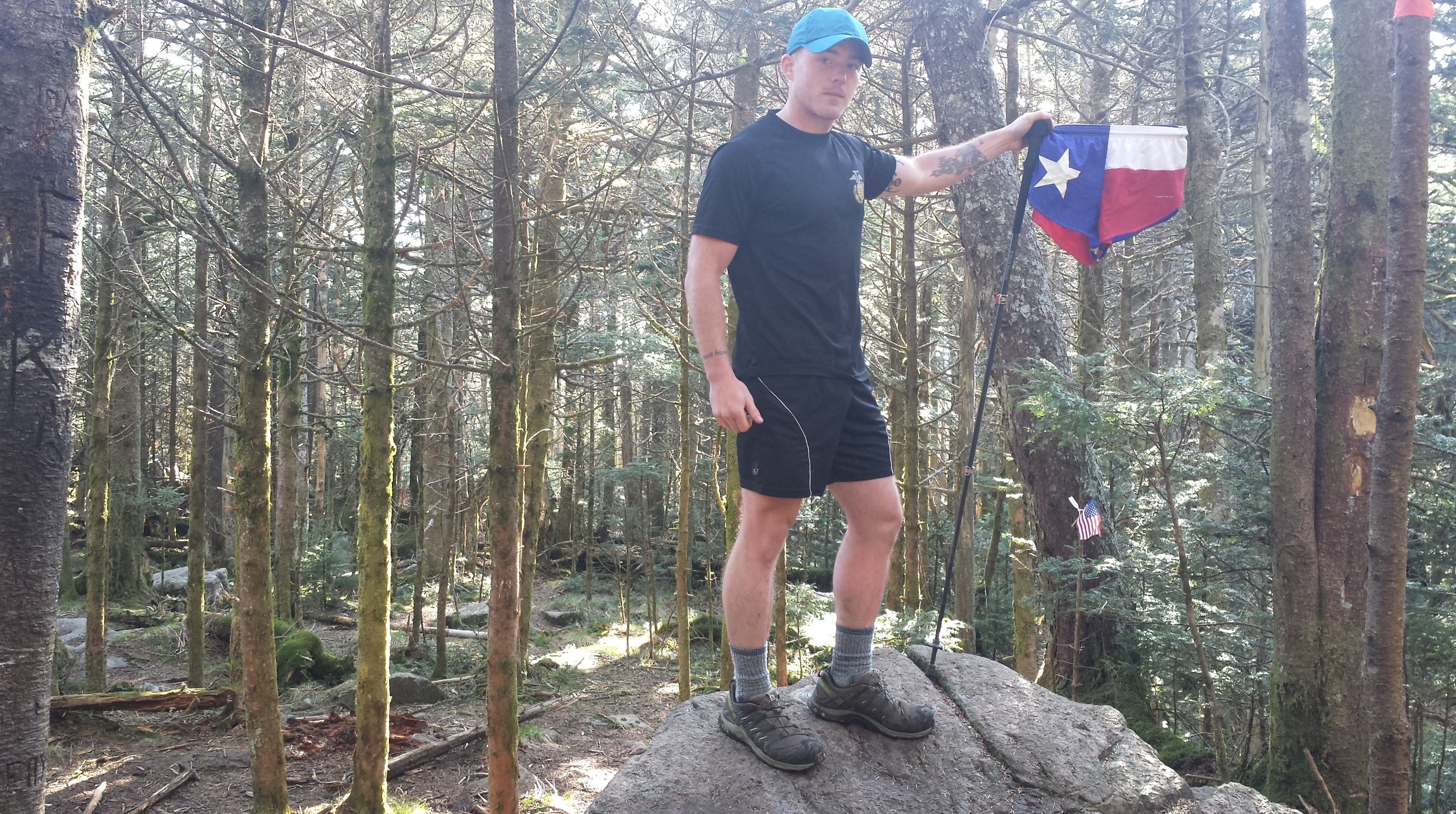
It’s been a while since I have written anything. I’ve been just as active in my adventuring as before, but the desire to write afterwards has not really been there… which is unfortunate, because I spent three sunny days in the White Mountains, went on a forty-six mile canoe trip with some friends, and an eighty mile hike from inside Shenandoah National Park to Harper’s Ferry, WV. So without further ado… here is my latest adventure.

download (3)

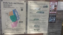
Dolly Sods Wilderness Area encompasses nearly 18,000 acres high up on the Alleghany Plateau in West Virginia. It was originally used by the Dahle family (hence the name Dolly) as a place for their sheep to graze. In the 1940’s the United States Army used the plateau as an artillery firing range, and in 1975 it was designated as a Wilderness Area by Congress. There have been several sweeps of the area for old shells, but they can still be found, so it is highly recommended by the Forest Service that you stick to the established trails and camping areas.

One of the many jaw-dropping meadows I passed through

I drove up to the Wilderness on Thursday afternoon after I had finished my classes for the day. I had heard that Dolly Sods was in full bloom, and I have wanted to go there for a while so it seemed like the perfect time. I was not disappointed. To get to Dolly Sods you have to drive up Forest Road 75, a very narrow and winding dirt road up the mountains, for five miles. There were a few times when I had to back down the road to a wider area so that other vehicles coming down the mountain could pass, but it is lined with trees hanging over the road in shades of brilliant yellows and oranges so I didn’t mind, and instead took my time, drinking up the scenery.

download (19)

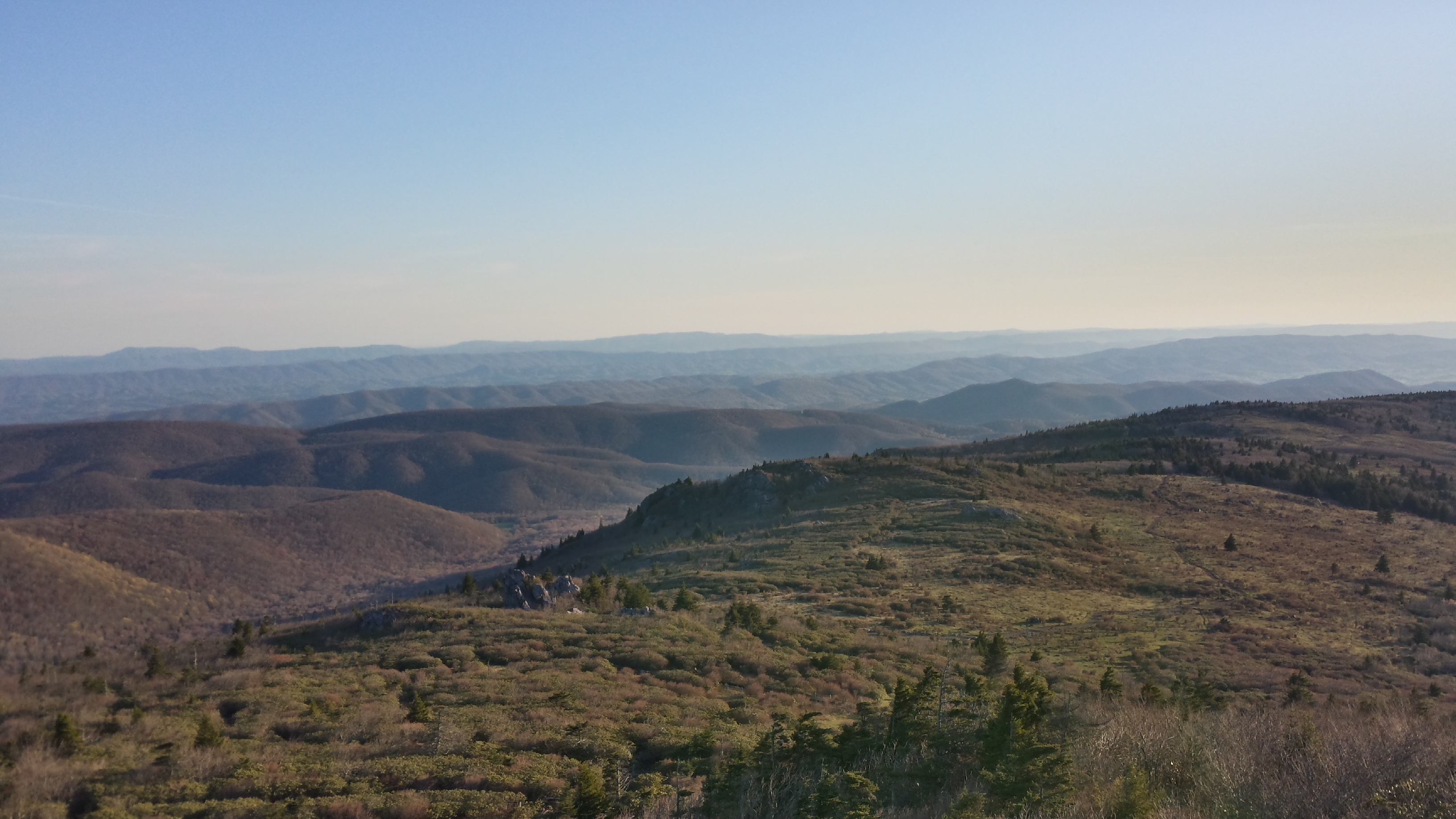
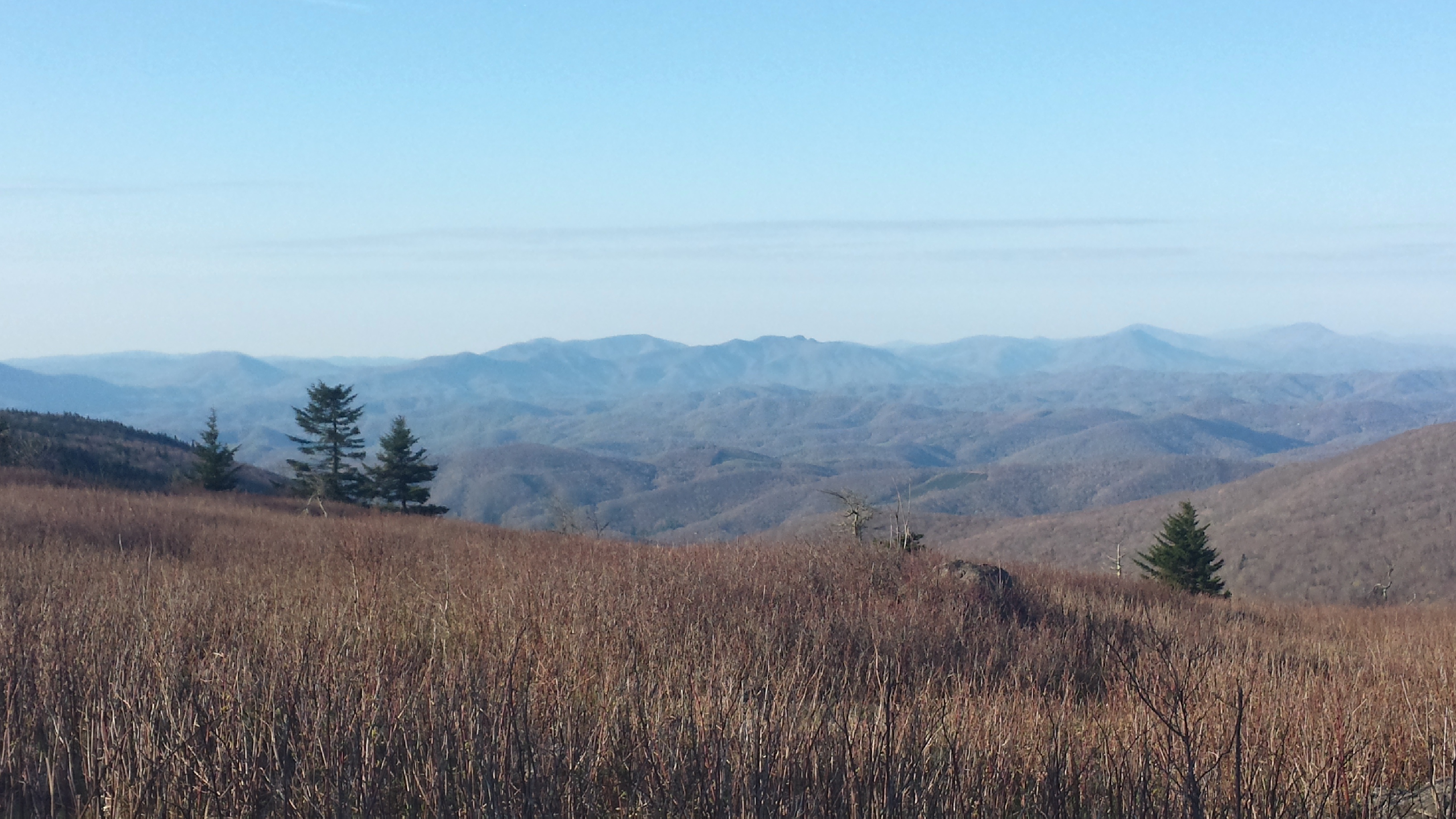
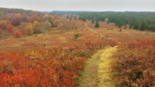
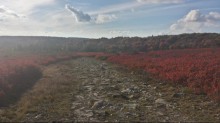
Once I got to the parking areas at the top of the plateau my jaw dropped. I had scoured Instagram for pictures of the area beforehand, but they did not do the place justice. Everywhere I looked something was blooming. The huckleberry bushes that cover the open areas had turned shades of a deep, bright red, and you could see the trees in distant valleys bathed in red, gold and orange. I couldn’t help but think to myself that this must be nirvana.

download (5)

download (4)

download (6)

Sunny skies, temperatures in the mid sixties and no wind created the perfect environment for hiking. I began down the Bear Rocks trail which winds its way through a vast field of huckleberry bushes and into the tree line, along with an arguing couple in front of me and a group of six teenagers and one adult behind me. This place is very popular so I didn’t expect to have it to myself with such great weather, but I decided to turn on the jets to distance myself from them and get some quality alone time with nature.

download (7)

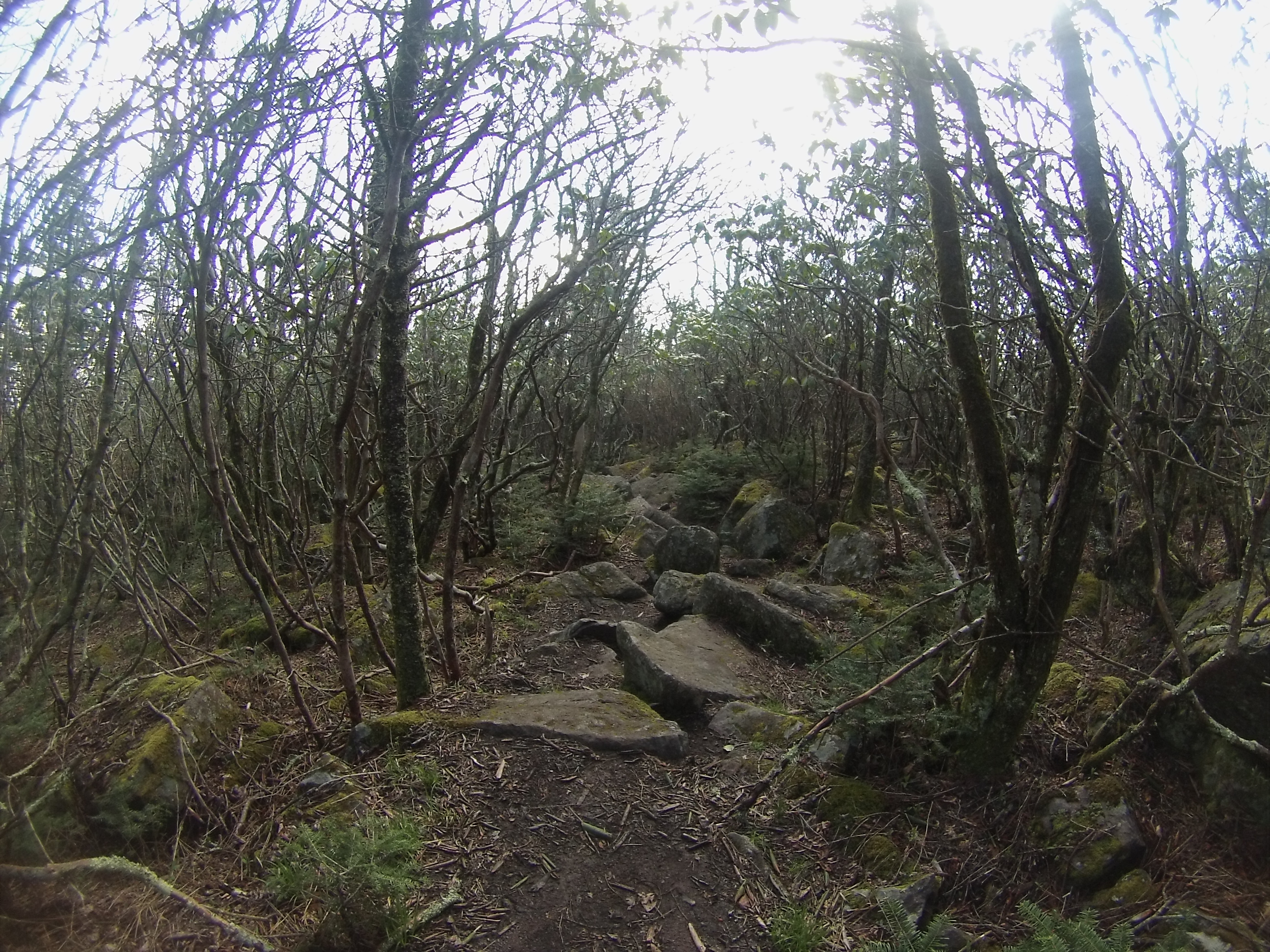
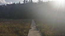
While there are no bridges over the numerous streams, there are several boardwalks over the bogs. I can only imagine that they were placed there after an accident or two. For those who don’t know, bogs have the ability of swallowing a human if they walk on it, so I was very grateful to have a little bit of human help on this trip.

download (8)

download (9)

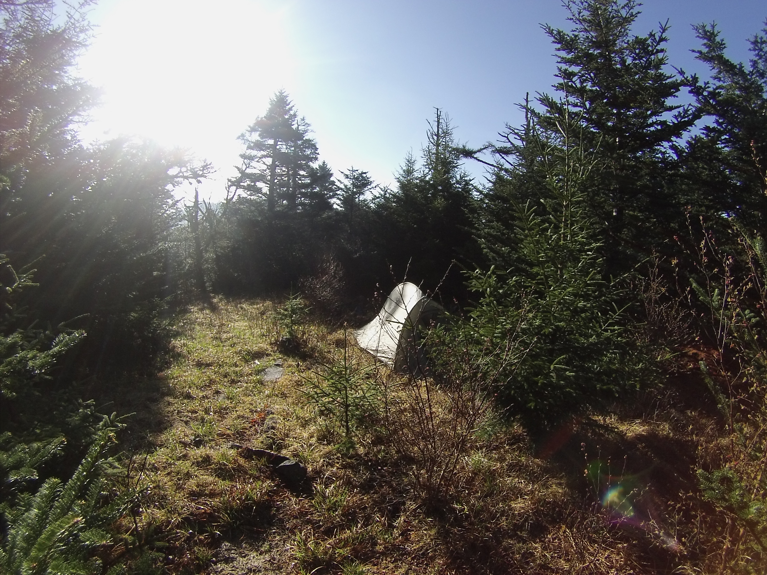
After traipsing across the bogs, through the forests and several large meadows I came across a man from the Ohio River Valley who was out for the day photographing the fall foliage. We talked about the area for ten minutes, and as I was heading out to resume hiking he described a wonderful camping site to me about a half mile away. It was on a high hill in the middle of one of the meadows, and had a nice fire ring with plenty of wood to burn already stacked there.

download (10)

download (11)

Obligatory selfie in my Marine Corps silkies at campsite

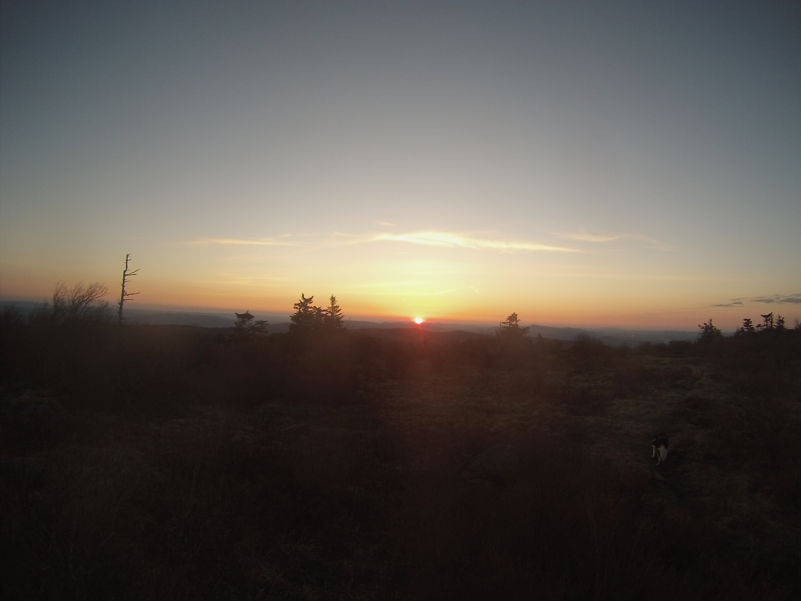
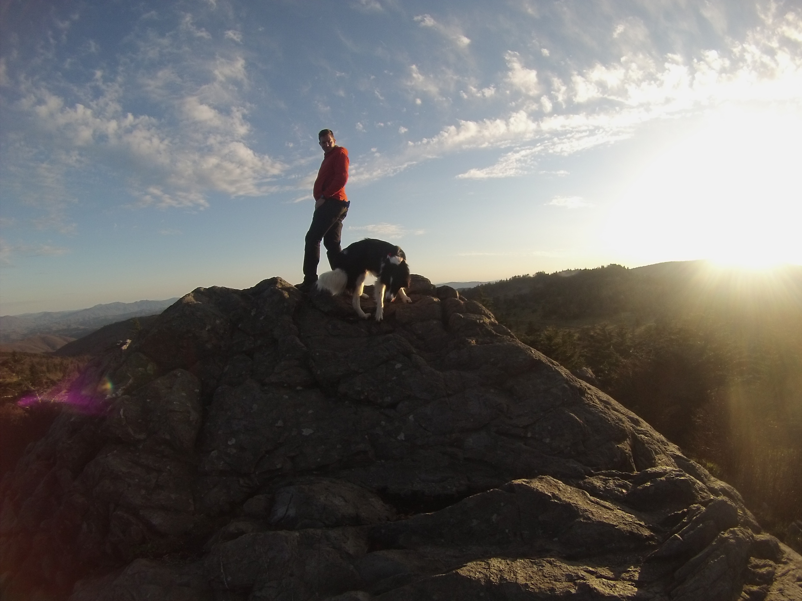
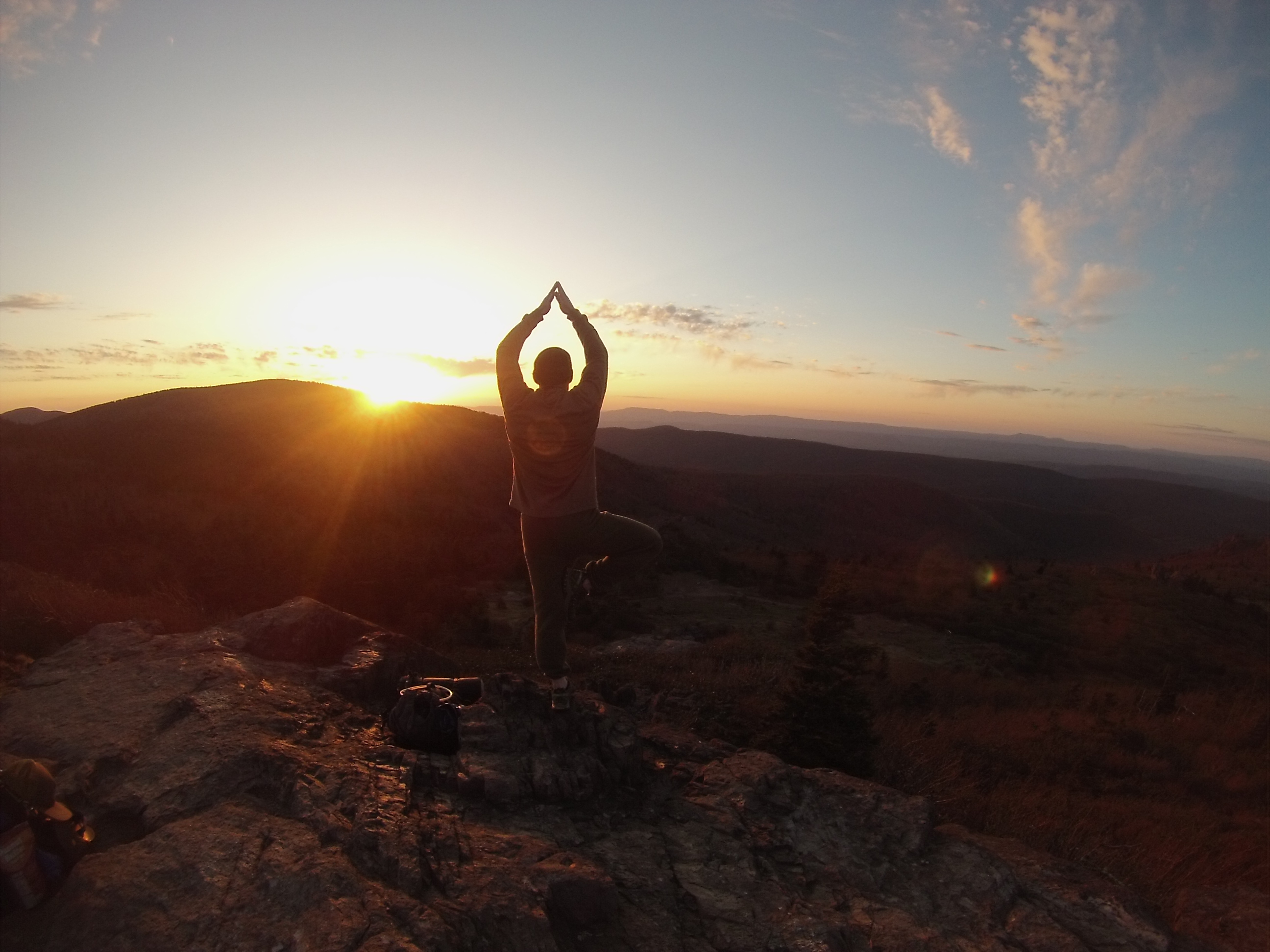
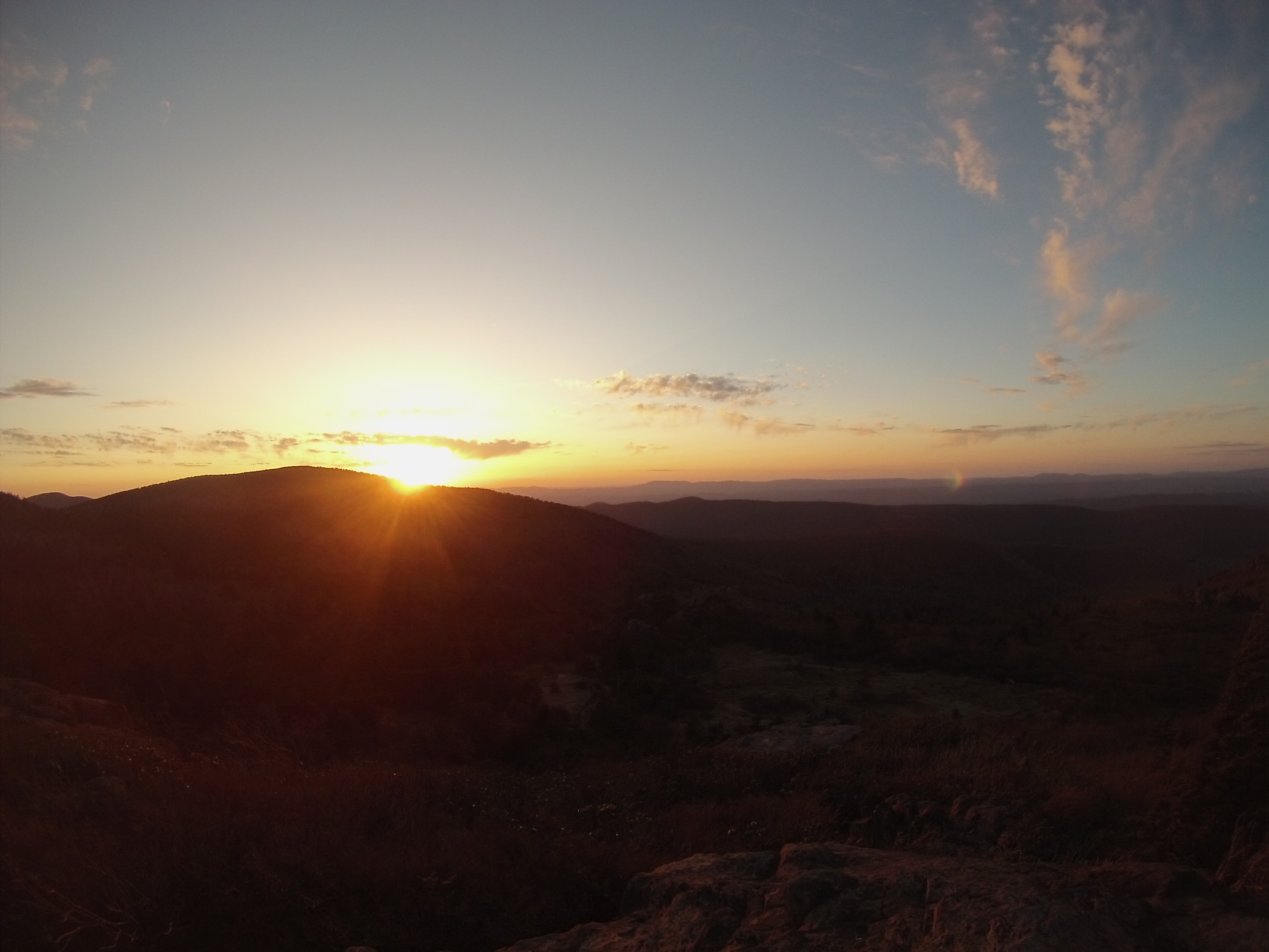
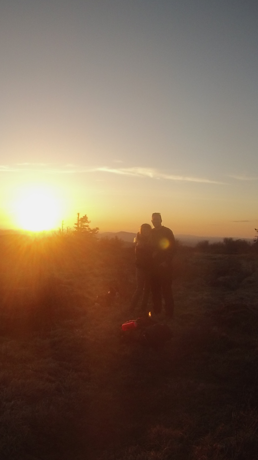
I arrived at the spot thirty minutes before the sunset and set up camp. Having read the weather report I knew that there was to be no rain that night, so I left the rain fly off of my tent and just used the netting and frame to keep the bugs off of me. Of course, Murphy had to come calling though, and at 5 am I was awoken in a downpour. I still enjoyed the experience though; I had a great vantage point for the sunset and made a nice fire that evening.

download (13)

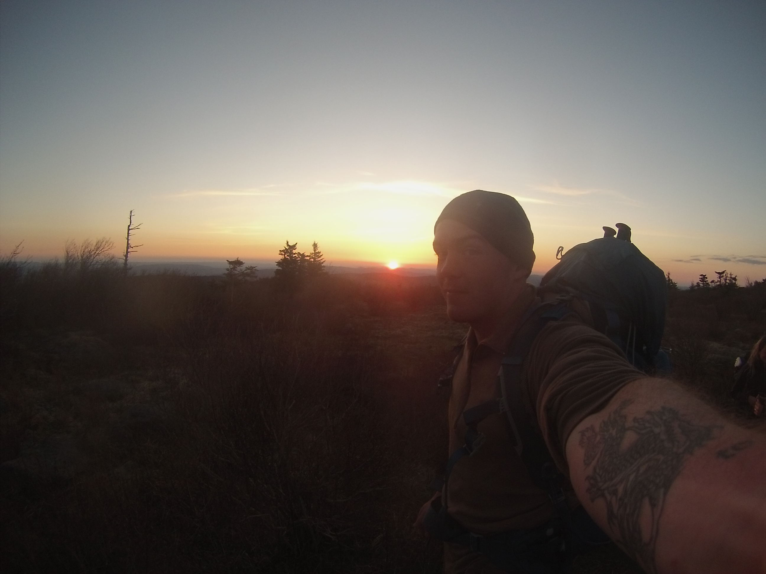
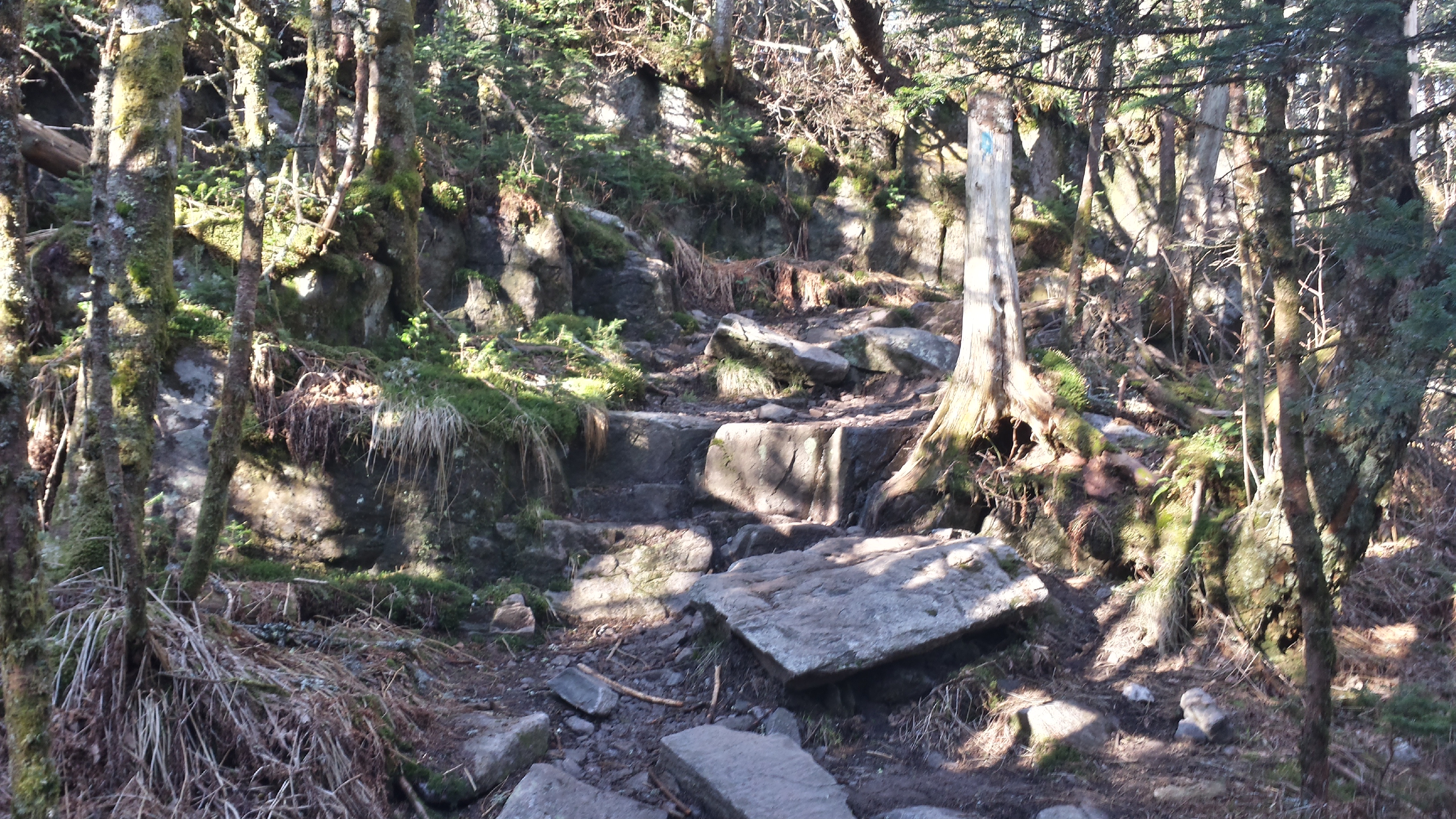
The next morning I set out to explore more of the wilderness. After a mile of walking through the forest and some particularly wet and muddy sections of the trail, I found myself on a ridge and decided to stop for a hearty breakfast of hashbrowns, eggs, onions and peppers thanks to Mountain House.

download (16)

I'm still hungry!!
I’m still hungry!!

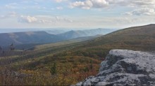
Setting out across the ridge, I came upon a side trail that looked like it went to the edge of the ridge overlooking a valley to the north. Twenty yards down the path I happened upon the Ritz Carlton of camping sites. There was a huge fire ring, and somebody had stacked the slate rocks to form a couch overlooking the valley! I know where I will be camping next time around.

download (15)

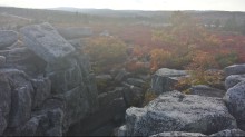
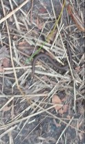
I didn’t end up doing the whole circuit that I had planned because I came across a large boulder field and couldn’t find the trail. I even walked across it and scoured the forest edge on the far side, but after an hour of searching I gave up and turned around. I was a little disappointed at first, but circumstances don’t always work out exactly how you plan, so I struck the negative thoughts from my mind and continued to enjoy the experience! On the way back I came across a little snake, maybe four inches long, and a few deer. I couldn’t identify the snake, but I enjoy observing the different creatures that inhabit the areas I’m exploring.

download (17)

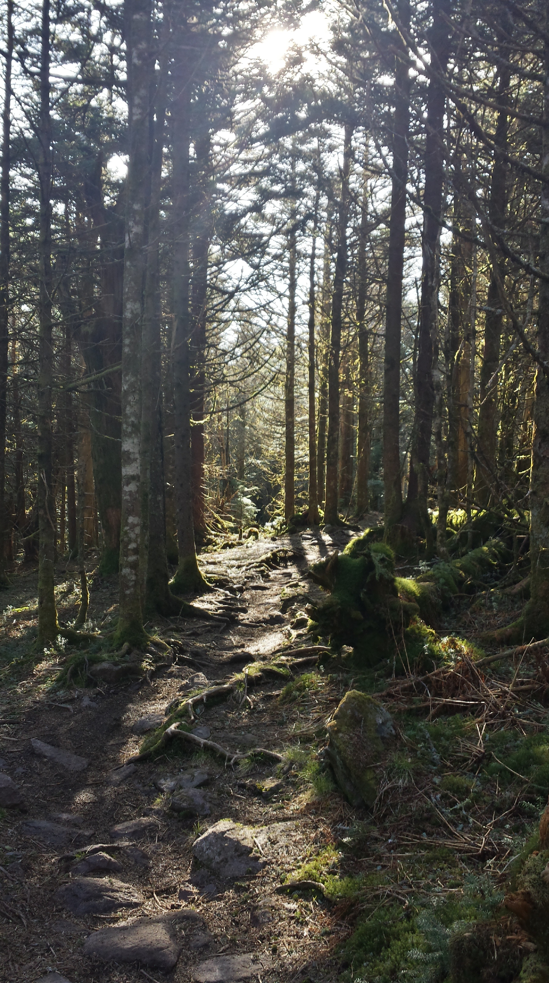
It felt like overnight the colors had only gotten more brilliant, or maybe my senses were heightened being alone in the wilderness. Either way, I happened across a gorgeous stand of trees on the way back, and from it the most enamoring smell was emanating.

download (1)

I arrived back at the parking area at 11:50 am and made a huge cup of coffee with my Jetboil Java Press. I didn’t have to be back in Stafford until 7 pm, and I didn’t really want to leave anyways, so I decided to drive around a bit. I explored Forest Road 75 some more, driving south, and then went back down the mountain the way I came up. Once I arrived at the bottom I still had six hours to kill, so I drove west through the mountains and into the town of Davis, which proudly calls itself the highest incorporated town in West Virginia. Along the way to Davis, I drove past a Juvenile Detention Center. Very isolated, I thought it was probably the perfect place for such a facility. Once I drove by the road it was on, I couldn’t help but laugh, because it was named Forestry Camp Road. I can only imagine some of the conversations that take place about the irony of the name in relation to what it actually is.

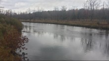
I found a wildlife management area on the edge of town and decided to check it out. I drove three miles to the back, and stopped at a few docks that went out on the stream, and chatted with an elderly couple who were living in an RV at one of the camp sites.

download (18)

At 3 pm I decided it was time to head back, but I wanted to keep exploring small towns and decided to take Old Route 55 instead of I-43, which it parallels. The old route was nothing but hills, going through small towns with 25 mph speed limits, and passing through farmlands. The small valley was all private property, so the route went up and down repeatedly over the sides of the mountains; it was so steep at times that I had to stay in third gear because I lost speed trying to use fourth gear to go up the mountains.

On I-66 I was reminded of something I try to keep in the forefront of my mind: expectations breed resentments, which lead to anger. Driving the posted speed limit on the highway seems like something one could reasonably expect, but not in Virginia. The highway is split into four lanes here, two going each way separated by a median. This particular section saw the opposite side elevated fifty feet. There had been an accident on the opposite side of the highway, and people slowed down in both lanes to 45 mph! There was nothing threatening us on the east-bound side, so I got frustrated for fifteen seconds and then reminded myself it really isn’t that big of a deal. Completely unrelated to adventuring, but I figure someone might get something good out of that!

Overall it was a very amazing trip, and I am blessed to be able to explore as much as I am. Next weekend I am meeting my mom, step dad and sister in the White Mountains of New Hampshire to check out the New England fall foliage and do some hiking, so stay tuned for more pictures!

Grayson Highlands

DCIM100GOPRO

In September the section I work with had an essay contest over the 14 Leadership Traits in the Marine Corps. The essays were to be written on which trait you think is the most important, why and what you as an individual can do to further the chosen trait. The winner would receive a day off from work in conjunction with a weekend of their choosing. I elected to write about “unselfishness”, and won.

Fast forward seven months.

It’s Thursday afternoon and I was checking the weather forecast for the weekend so that I could go backpacking. Usually I go to Shenandoah National Park because it is somewhat close to Quantico, but the forecast called for rain on Saturday. I decided to take my day off the next day and head five and a half hours south, to the Grayson Highlands, which are famous for their breathtaking views and wild ponies.

20150503_072600_Richtone(HDR)

Back in the early 1900’s the mountains were logged and rendered bald. Wild ponies from Assateague and Chincoteague Islands off the coast of Virginia were introduced to graze on the mountains and keep them free of trees and shrubbery. The result was a State Park with some of the most beautiful scenery on the east coast.

20150503_071341_Richtone(HDR)

I got to Grindstone Campground, in Grayson Highlands State Park, at about 4:00pm on Friday, changed into my hiking clothing, and hit the trail. My destination for the evening was roughly eight miles away, at the Thomas Knob Shelter along the Appalachian Trail.

Hiking up the trail was relatively normal at the lower elevation, with a well-worn trail and flora beginning to become green again. Once I got to the higher elevations, however, it got even more interesting. I was hiking in thick fog, creating a spooky yet peaceful environment for a solo-hike, and once I reached 4,000 feet Spruce-Fir forests began to take shape, while the trail steadily become more rocky and small springs began to permeate the trail.

I reached the shelter at 7pm and set up camp for the evening in a small clearing a few yards from the Appalachian Trail. The fog had receded some, but I couldn’t watch the sunset because it covered the mountains for the most part. That night I didn’t get much sleep, between the ponies romping around my tent and the moon shining inside of it.

DCIM100GOPRO

I woke up at 6am Saturday morning to watch the sun rise, but the fog was swirling thickly and reduced visibility to twenty feet. I decided to get some more sleep, and got back up at 8:30am, made coffee in my Jetboil (with the Java Press, an excellent addition for any coffee connoisseur) and broke camp.

Walking through the forest along the ridgeline, I encountered the first group of wild ponies half a mile down the trail. You would expect the ponies to be spooked by humans, but since the Appalachian Trail passes directly through their territory they are used to humans feeding them, and will walk straight up to you. The first pony that approached me began licking my arm to get the salt from my skin.

DCIM100GOPRO

After leaving the ponies to continue my hike, the trail devolved from forests and wound its way through some tall shrubbery. I was looking for the Pine Mountain trail, which I had read about on the internet. I completely missed the trail, but fortunately another hiker had just passed a small sign and pointed me in the right direction (and is now following me on instagram; isn’t social media great?).

Hiking on the Pine Mountain trail brought about even rockier terrain, as the trail descended towards the bald sections of the park. I love hopping from rock to rock, so I had no complaints, though I passed a heavier set man who had twisted his ankle on a particularly rocky section. After seeing a clearing in the woods to the right, along with a sign for another trail, I switched to the Crest Trail.

DCIM100GOPRO

The Crest Trail is essentially a shoal road that you would find on a ranch back in Texas. There is also a massive amount of horse crap, because the Grayson Highlands have some of the most scenic trails for horse riding in the state. The views do not disappoint, since the trail follows the crest (imagine that!) of a mountain, and offers up many points to stop for a break cleverly disguised as a photo op.

5 miles of walking into the morning I reached Scales. Scales is a huge corral, with a privy, park maps and a spring located inside it. Scales is also the place where a portion of the wild ponies are herded every September and sold at auction. It is located at a gap in the mountains, and is a huge intersection for trails, including the Appalachian Trail and the Virginia Highlands Horse Trail.

My plan was to hike four more miles from Scales to the Old Orchard shelter along the Appalachian Trail.  Then I ran into the Boy Scouts.

I am happy that organizations such as Boy Scouts exist, but not near me. This particular troop consisted mainly of 10 year-olds, and they were obnoxiously loud. When I’m hiking I don’t want to be around a bunch of young kids yelling every thirty seconds, so I changed course and headed down the Virginia Highlands Horse Trail.

The Horse Trail was rated high on hikingupwards.com by a fellow hiker, but I turned around after the first mile of it, as it descended into the valleys, and I had soaked my shoes three times already (the trail was essentially a small stream of water and horse crap). I hiked off of the trail to the right and began bushwhacking my way back to the Crest Trail.

After a few miles I ran into three hikers at the intersection of the Crest Trail and Appalachian Trail. One of the men was a Navy Corpsman in the seventies, and struck up a conversation about the Eagle, Globe and Anchor on my shirt. After shooting the shit for ten minutes they invited me to eat lunch with them, so I accepted.

One of the beautiful things about hiking is that people tend to be more pleasant and open to talking with strangers. We talked about everything from time in the service (the two older men were in the Navy and Army) to different trails we had hiked. We eventually arrived at the topic of alcohol, with me telling my experiences and talking about how I was sober now, and they told me of their struggles after the service. One of the men had been a burnout for several years after separating from the Army, but got his act together and is now a doctor conducting brain research. It always amazes me how far you can go if you put down the bottle and apply yourself!

After we parted ways, I decided to head back towards the Thomas Knob Shelter, as it has great views when the skies are clear. I had no idea where I was going to set up camp, but wandered onto the most amazing panorama of mountains and valleys I have ever seen.  I was going to set up camp on a random clear section of trail, but ran across a few perfect campsites in the tree line right off of the trail.

20150503_075310_Richtone(HDR)

After picking a spot and setting up camp, I noticed that there was another camp a few yards away. Having brought no lighter, and wanting a fire in the evening, I walked over and asked where the nearest spring was and if the guy had a lighter to spare later on. That turned out to be one of the best decisions I made that whole weekend.

As it turns out, the people camping next to me were celebrating their one-year anniversary of being married in this gorgeous park. I congratulated them, and then got invited over to eat dinner with them and their dog, Hilo (rhymes with kilo).

DCIM100GOPRO

They were awesome. We talked about where we were from (they were from Tennessee) and what we liked to do. It turns out that Julian is an avid mountain biker, and outdoor enthusiast, who has been coming to this spot with his dad since he was seven. I was honored to be able to share the spot with them. He also knows the names and silhouettes of a lot of mountains. Since visibility was great that day, we were able to see Rocky Top, which he pointed out and told me was about 105 miles away.

After telling them I am from south of Houston, Julian told me he works at Dow, and they have been trying to get him to Freeport for a while. What are the odds! We both agreed that Tennessee would be a much better fit for his family.

Their dog, Hilo, was full of energy and loves to fetch and catch frisbees (he is very good at that). While we were throwing the frisbee for the dog I mentioned that my dad has had Vizslas since I was little and I really want one of my own. When I tell people the breed of dog I want they usually reply with, “what’s that?” But Julian told me he wants one too! Two guys who both want vizslas, in the same campground, what are the odds?

20150503_070850

After we ate our dinner, which consisted of some dehydrated backpacking meals (and half a block of some awesome cheese they gave me), we all walked over to a rock called Little Wilburn to watch the sunset. Since it was their anniversary, I hung out for a bit, but opted to let them enjoy it alone and watched the sun set from another rock in the vicinity.

DCIM100GOPRO

There were a few other people where I was, all watching the sun set behind Mt Rodgers, and we made small talk. From a completely random conversation, I discovered that two of the guys had just finished a year at Liberty University and knew the people I randomly camped with at McAfee Knob two weeks ago! Coincidences abounded on this trip.

DCIM100GOPRO

That evening, after returning to camp and grabbing my headlamp, I decided to do some night hiking. The moon was full and the sky clear, so I didn’t need the extra light. I walked around two miles along the Appalachian Trail, passing ponies asleep in the fields, and up to the top of Big Wilburn where I nestled into a chair-like portion of rock and watched the valleys in the distance. I looked up in the sky at the stars and moon, and let my mind wander freely. Within thirty seconds I had seen two shooting stars.

I returned to camp and slept very warmly in my sleeping bag, due partly to the fact that my legs were bright red from sunburn and were radiating a nice amount of heat. I woke up at 5:30 the next morning, broke camp and fixed up some coffee, then headed to Big Wilburn to catch the sun rise with Julian, Erin and Hilo. We didn’t make it up Big Wilburn in time, but we were rewarded with such a gorgeous sun rise that it didn’t even matter. We took a few photos, exchanged information and said our goodbyes. Thanks for sharing your time with me guys, I had an amazing time.

DCIM100GOPRO

I started the hike back to Grindstone, and was enjoying the crisp mountain air and the smell of the fir trees when nature came knocking. The dehydrated meals and countless cliff bars I had consumed over the weekend came back to my mind, and I hurried off the trail a ways.

When I reached Thomas Knob Shelter again I came upon several thru-hikers. We talked about the trail and their favorite parts so far, and I told them of my upcoming thru-hike. A lot of people, one of the guys I was talking to included, complete the trail in roughly six months and always call me crazy when I say I’m starting a northbound hike in mid June. Usually it doesn’t phase me, but this guy really rented a piece of my mind for a while that morning.

After he had finished telling me that he wasn’t active and didn’t train for the trail at all, he proceeded to inform me that my attempt was doomed for failure, and that I couldn’t start off doing consecutive fifteen mile days. I bit my tongue and humbly said I appreciate his opinion, but my mind was firing off retorts. “I’m a Marine, I walk every day and regularly do 20 mile days on the weekend” is exactly what I wanted to say. But I didn’t. After a while I decided there was no good coming out of stewing over his negativity, and put it in the back of my mind.

Since it was on the way, I took the spur trail to the summit of Mt Rodgers, the highest point in Virginia at 5,720 feet. The trail up was stunning as I got in the woods; moss covered trees and rocks, roots consuming the trail and stray rays of light filtering through the canopy captured my attention. It was as if I stepped into a Tolkien novel and was walking through Fangorn Forest.

20150503_082704_Richtone(HDR)

20150503_082515_Richtone(HDR)

The summit is relatively boring and has no views thanks to being surrounded by trees, but I was not about to let that ruin my fun. I attached my Texas flag running shorts to a hiking pole, fashioning a makeshift flag, and posed with it at the summit.

20150503_084955

All in all, this was an amazing trip, and definitely the most beautiful I have been on. I hiked 32 miles, took over 400 photos and 12 videos, got sunburnt and cut, and managed to crack the screen on my phone. The people are what really made it awesome, though, and I am so grateful for each and every person I came across. I am now putting together a group of people in my unit to go back to the Grayson Highlands this coming Memorial Day weekend so that I can share another great experience with them.

Screenshot_2015-05-05-21-28-38

Julian, Erin and Hilo

1430667557098

Stinky, sunburnt, satisfied